
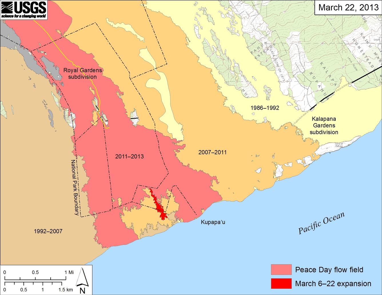
Peace Day flow field on coastal plain
Detailed Description
Large-scale map showing the mapped flow expansion on the coastal plain from March 6 to March 22 in bright red. Light red represents the extent of the Peace Day flow from September 21, 2011, to March 6, 2013. Older flows are labeled with the years in which they were active. Active surface flows are scattered about the interior of the Peace Day flow and include the new lobe of lava (in bright red) extending to within about 250 m (820 ft) of the ocean. Lava continues to enter the ocean near Kupapa‘u Point on both sides of the National Park boundary.