
pie_chart.jpg
By California Water Science Center
April 2025 (approx.)
Detailed Description
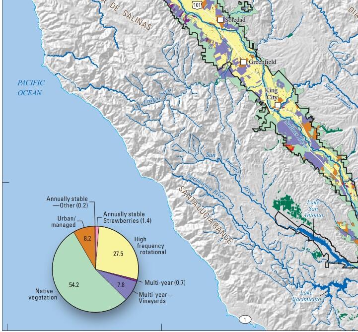
Land use map of the Salinas Valley. Base from U.S. Geological Survey, The National Map (2023) and other Federal digital data, various scales; Albers Equal-Area Conic projection, standard parallels 29°30’ and 45°30’ N., central meridian 121° W.; North American Datum of 1983.
Sources/Usage
Public Domain.