
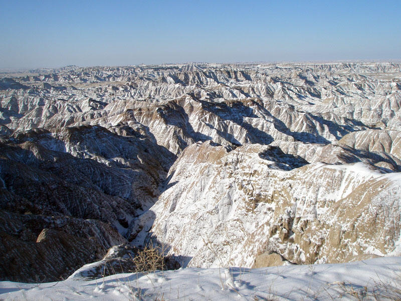
Pinnacles Overlook
Detailed Description
This view from the Pinnacles Overlook shows a seemingly endless belt of badlands north of the White River valley (distant left). The rugged, vegetation-barren badlands of the White River Group rise to an ancient surface level that was probably a continuous flat prairie surface before climatic changes and periods of continental glaciation changed regional drainage patterns. Rivers draining the Badlands area (including the Cheyenne, Bad, and White Rivers) eroded downward through their floodplains, forming canyons, beginning about 2 million years ago. Erosion, influenced by the character of the sediments of the White River Group, climate, and even biology, produced the Badlands landscape we see today.
Sources/Usage
Public Domain.