
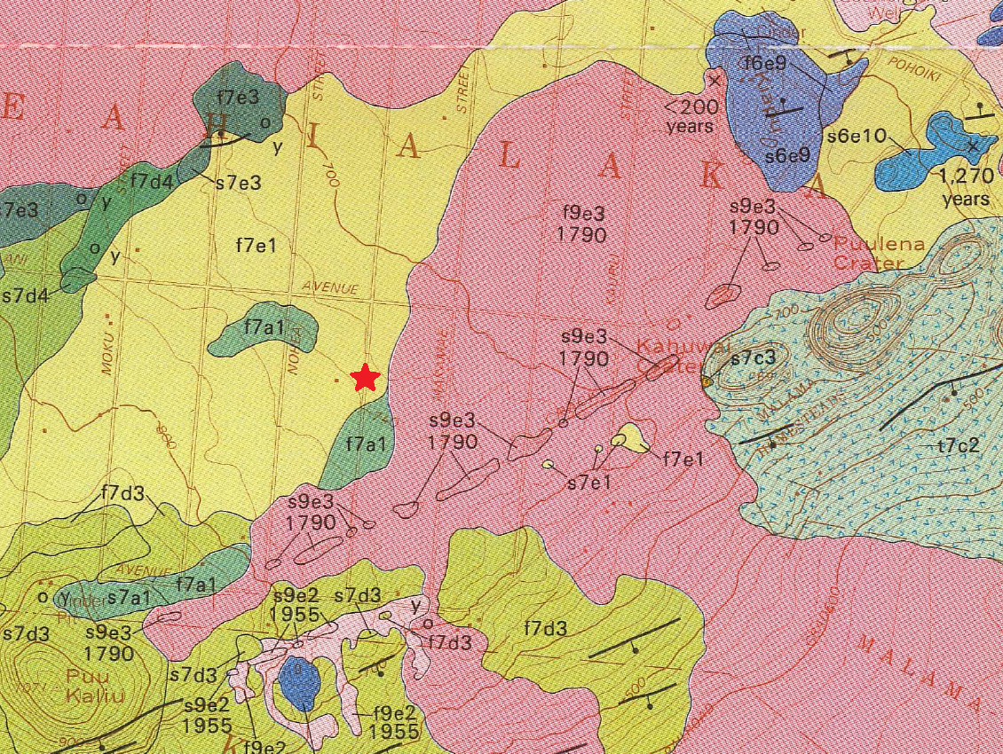
Portion of the Geologic map of the lower East Rift Zone of Kīlauea
By Kīlauea
1991 (approx.)
Detailed Description
Portion of the Geologic map of the lower East Rift Zone of Kīlauea Volcano, Hawai‘i by Moore and Trusdell (1991), showing the southeastern part of the Leilani Estates subdivision. Some geologic units depicted here are now buried by 2018 lava flows; a red star marks the location of fissure 8. The large pink area depicts lava flows and vents from an eruption in CE 1790. Labels correspond to geologic units described on the full map sheet.
Sources/Usage
Public Domain.