Prairie Band Potawatomi Nation
Detailed Description
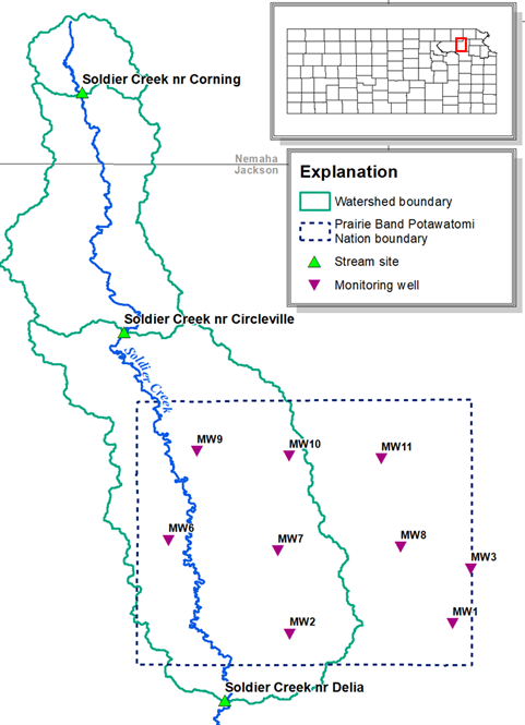
A map of the Prairie Band Potawatomi Nation and the surrounding watershed. The map shows Soldier Creek with three monitoring sites and nine montioring wells that reside inside the Prairie Band Potawatomi Nation boundary.
Sources/Usage
Public Domain.
Related
Effects of Soil Health Best Management Practices on Water‐Quality and Soil-Moisture in Soldier Creek, Nemaha County Kansas
In October 2020, The U.S. Geological Survey, in cooperation with the Kansas Department of Health and Environment (KDHE), began long‐term in‐stream monitoring downstream from the headwaters of Soldier Creek, a KDHE identified basin with a high probability of large‐scale implementation (more than 50% of area) of soil health best management practices (BPMs) to quantify potential changes in streamflow...
Surface Water and Groundwater Availability and Quality in the Prairie Band Potawatomi Nation Reservation
The Prairie Band Potawatomi Nation (PBPN) in Jackson County, Kansas lies within the Big Soldier and Little Soldier Creek basins. The PBPN needs surface and groundwater quality and quantity data for water management purposes and for developing and implementing a water quality program to protect the water of the reservation for the benefit of current and future generations. In January 2020, The U.S...


