
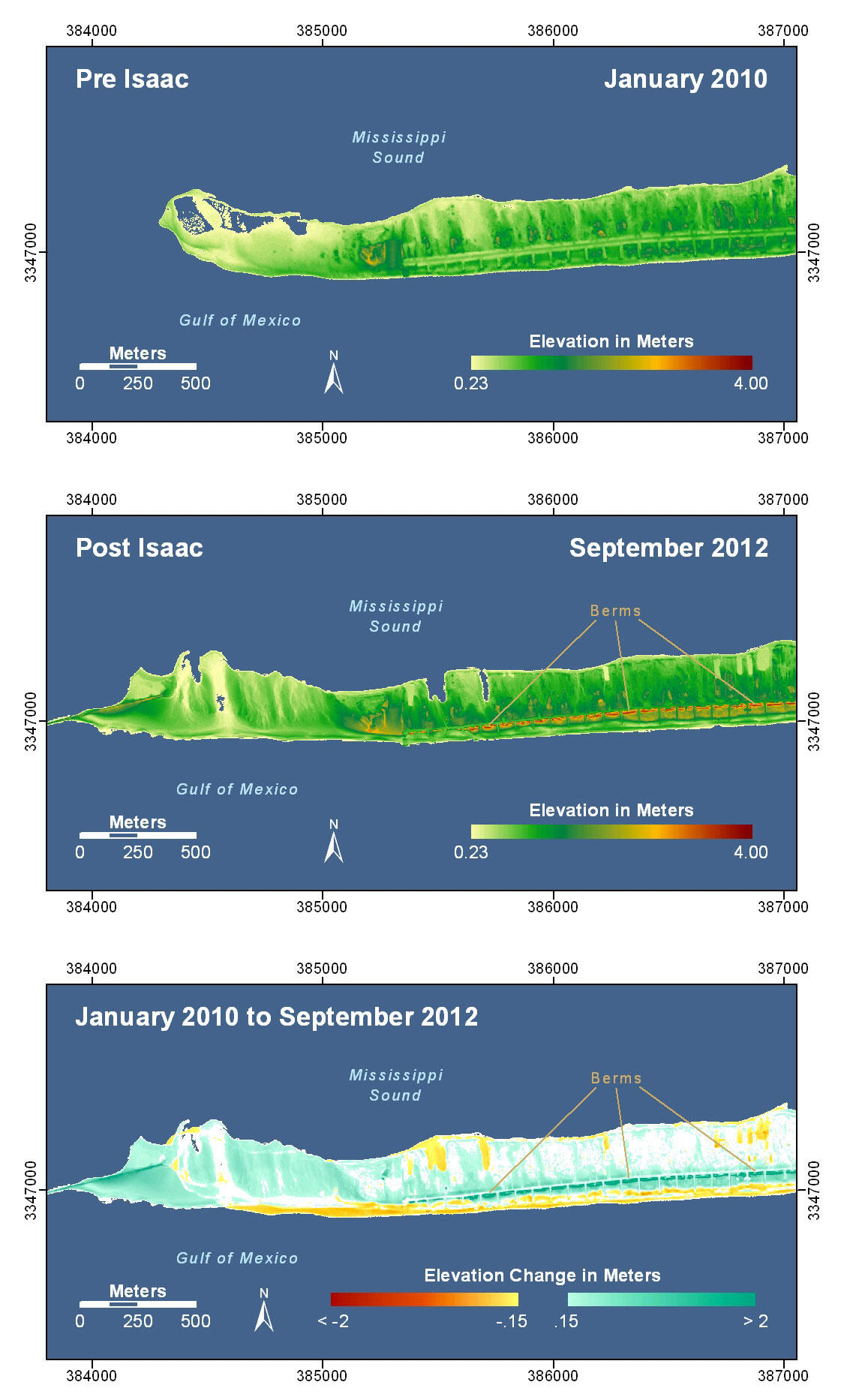
Pre-Storm and Post-Storm 3D Lidar Topography - Western Dauphin Island
Detailed Description
Western Dauphin Island, Alabama. The western extent of the inhabited portion of Dauphin Island experienced shoreline erosion and overwash. In the post-storm elevation map, a line of berms running west-east along the road form higher elevation features that were not present in the pre-storm elevation map and appear as regions of deposition in the elevation difference map. These berms were constructed after the pre-storm lidar data were collected and prior to Isaac's landfall. Overwash deposition appears north of the main access road. And the deposition at the western end of the map documents the construction of the structure that closed Katrina Cut (see photo pair Location 1). Houses were removed from the lidar data and are not represented in these maps.
Sources/Usage
Public Domain.
Public domain