
Puerto Rico Coastal Vulnerability Map

Detailed Description
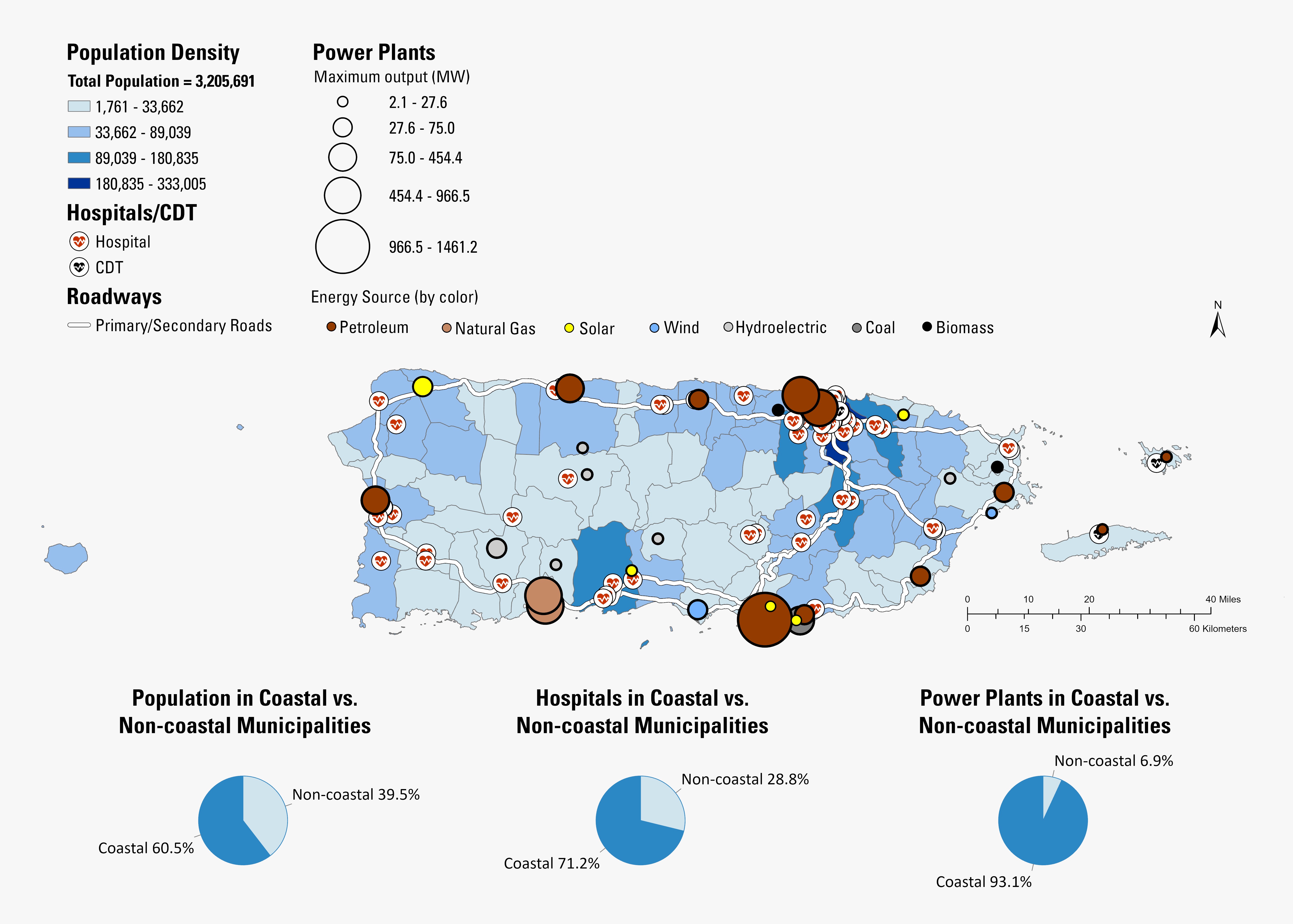
This map shows the coastal vulnerability of Puerto Rico. Population density, power plants, and hospitals are displayed on the map along with corresponding pie charts that represent the percentage of which these categories are coastally located.
Sources/Usage
Public Domain.