
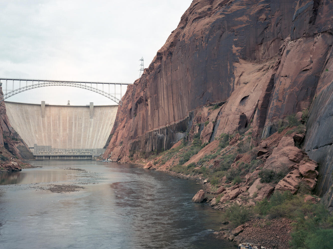
Repeat color photograph taken in 1992 of Glen Canyon Dam, a match to the 1889 image by Nims from the Stanton Expedition
Detailed Description
A USGS repeat color photograph of Glen Canyon Dam taken on October 29, 1992 as a match to the 1889 Franklin Nims image of the site before the dam was built, at Colorado River mile -14.7, during the Stanton Expedition. The view is taken upstream from river left. Stake (camera point) s2638 in the SBSC's Southwest Repeat Photography Collection.
Excerpt of the Stanton Survey History by Robert H. Webb, USGS, public domain (from the now unavailable webpage on the subject):
In May 1889, railroad engineer Robert Brewster Stanton, in collaboration with real estate investor Frank M. Brown, began a survey of the Green and Colorado River corridors. Their goal was to construct a railroad line from Grand Junction, Colorado to San Diego, California, one that would wind at river-level through several of the Colorado River’s canyons. While that expedition ended in disaster in July after three men—one of them Brown—drowned in Grand Canyon, Stanton successfully completed the survey that winter (1889-1890). The expedition quickly discovered that conducting the survey by instrument was far too time-consuming for their allotted time, so the men turned to line-of-site photographs taken on newfangled flexible roll film (rather than the cumbersome glass plates used by their predecessors). Although the railroad project never got past the planning stages, the photographs would prove to be invaluable as the basis for repeat photography a century later. From 1989 to 1995, the USGS re-photographed nearly all of the images that the expedition’s photographers—Franklin A. Nims and, after Nims was injured and left the expedition, Stanton himself—took in both Grand and Cataract Canyons. The photographs reveal changes in desert and riparian vegetation, rapids, and beaches, as a result of both natural and human-caused processes. Many of the Grand Canyon images were published in the book “Grand Canyon, A Century of Change,” by Robert Webb, and a selection of the Cataract Canyon images appeared in “Cataract Canyon: A Human and Environmental History of the Rivers in Canyonlands,” by Robert Webb, Jayne Belnap, and John Weisheit. In 2010, the USGS re-matched many of the images, both in Grand Canyon and Cataract Canyon.
In October 1956, the blasting began on the walls of Navajo Sandstone at this once obscure spot. In 1963, Glen Canyon Dam was completed and Lake Powell began to fill. At this point, about one-half mile downstream, a new horizontal stripe on the wall was created by seepage from the reservoir. The small sand bars that lined the banks of the Colorado River in 1889 have eroded away, although a large sand bar is present directly across the river from the camera station. Photo credit: Robert H. Webb, USGS.
Sources/Usage
Public Domain.