
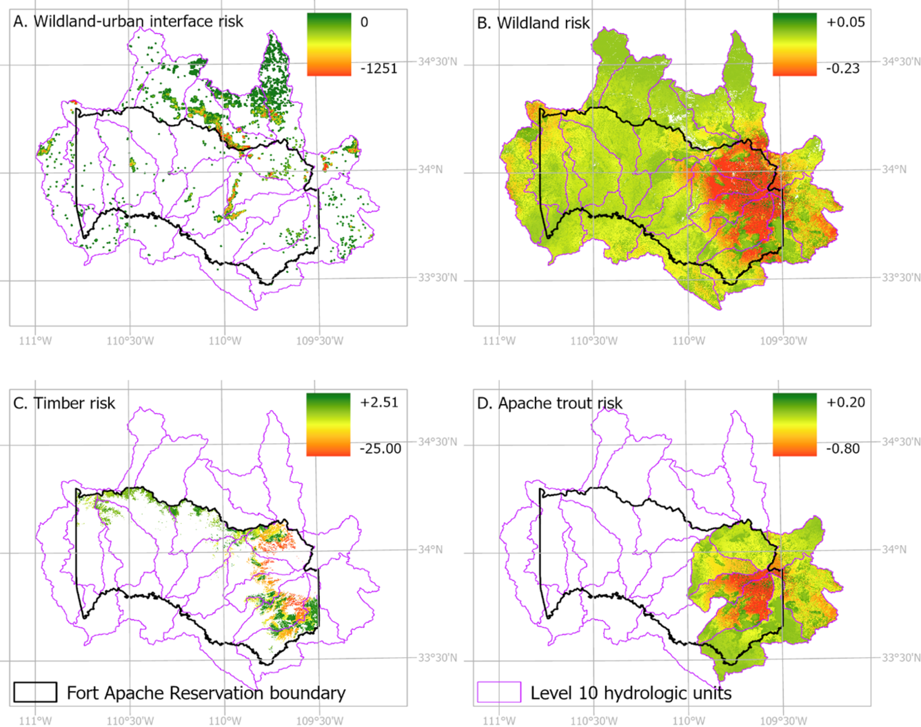
Risk of wildfire to Tribal values on the Fort Apache Reservation for wildland-urban interface, wildlands, timber resources, and Apache trout
Detailed Description
Four maps of the Fort Apache Reservation showing the risk of wildfire to Tribal values for A) wildland-urban interface, B) wildlands, C) timber resources, and D) Apache trout. Figure 4 in the USGS open access paper "Adapting wildfire risk assessment for a Tribal landscape: Mount Baldy and the Fort Apache Reservation in Arizona", https://doi.org/10.1007/s10980-026-02302-5
Sources/Usage
Public Domain.