



River mapping with an uncrewed surface vehicle
Detailed Description
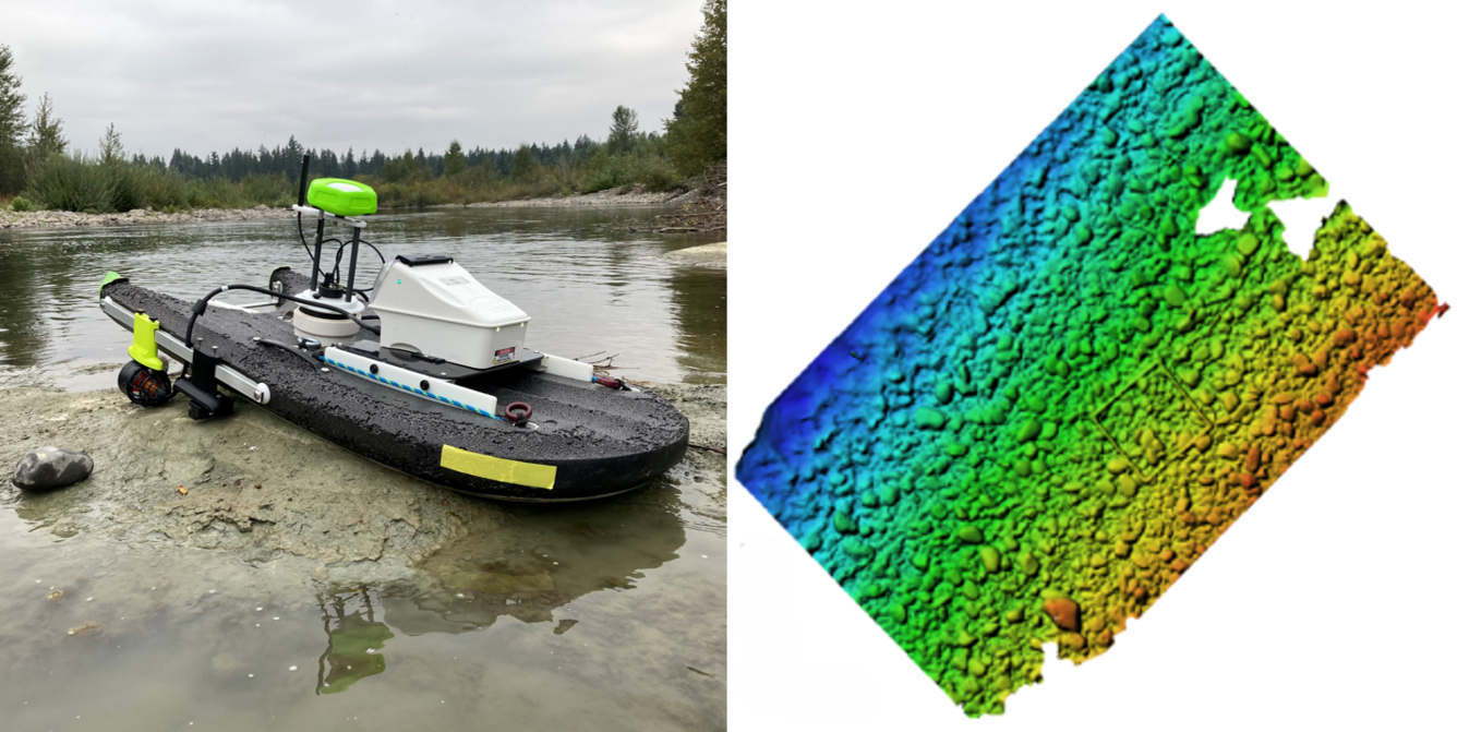
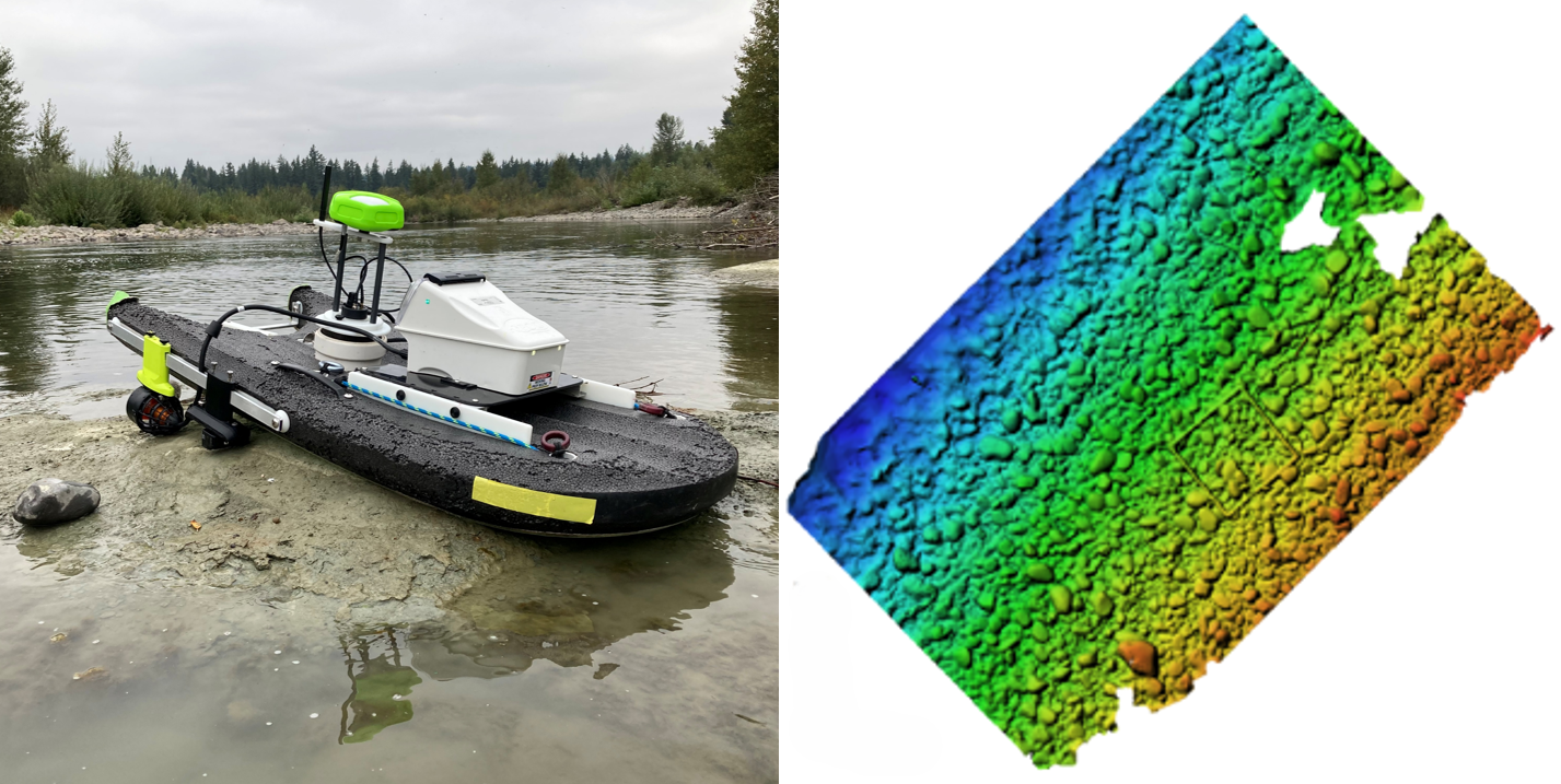
Left: A remotely controlled Uncrewed Surface Vehicle (USV) in a shallow river environment, outfitted with an Acoustic Doppler Current Profiler (ADCP) and a multi-camera array to map bathymetry and channel bed morphology. Right: The resulting high-resolution 3D map illustrates riverbed elevation using underwater imagery captured by the USV. The color gradient represents relative changes in elevation, transitioning from blue (deeper water or lower terrain) to red (shallower water).
Sources/Usage
Public Domain.
Related
Geospatial Data Collection in the Willamette River Basin
A USGS geospatial data collection initiative in Oregon’s Willamette River Basin uses advanced remote sensing and on‑the‑ground measurements to map major rivers draining the Cascade Range. This work helps track how changing water resources and river channel conditions affect a wide array of water‑management needs, river hazards, recreational users, and habitat for ESA-listed spring Chinook salmon...
Related
Geospatial Data Collection in the Willamette River Basin
A USGS geospatial data collection initiative in Oregon’s Willamette River Basin uses advanced remote sensing and on‑the‑ground measurements to map major rivers draining the Cascade Range. This work helps track how changing water resources and river channel conditions affect a wide array of water‑management needs, river hazards, recreational users, and habitat for ESA-listed spring Chinook salmon...