
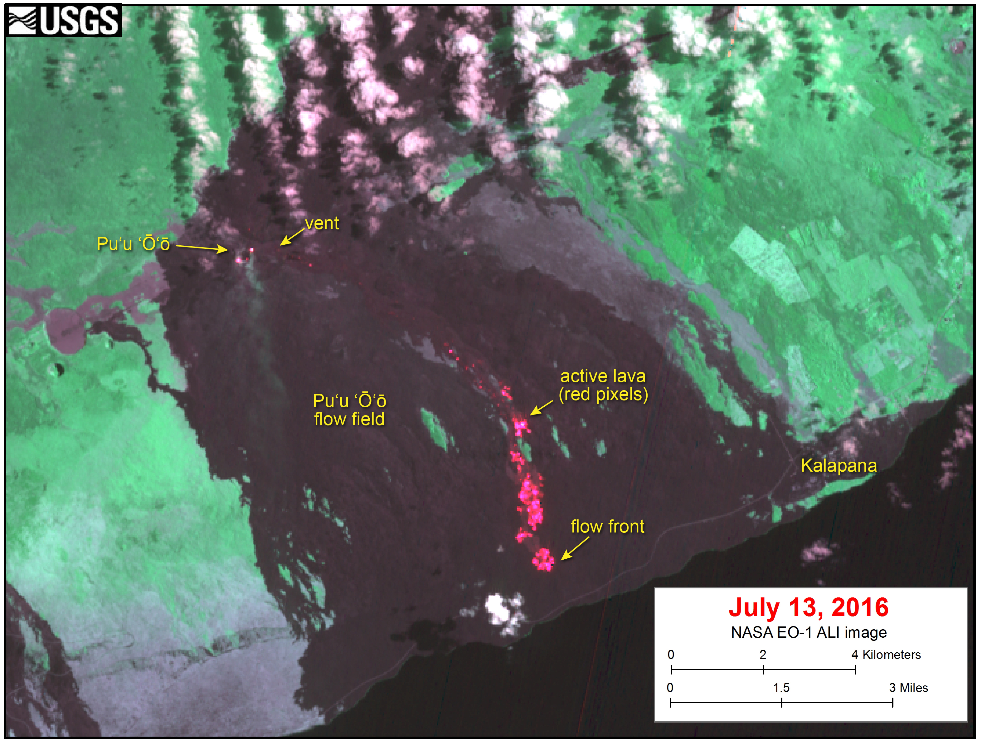
Satellite image shows Pu‘u ‘Ō‘ō lava flow

Detailed Description
This satellite image was captured on Wednesday, July 13, by the Advanced Land Imager instrument onboard NASA's Earth Observing 1 satellite. The image is provided courtesy of NASA's Jet Propulsion Laboratory. Although this is a false-color image, the color map has been chosen to mimic what the human eye would expect to see. Bright red pixels depict areas of very high temperatures and show active lava. White areas are clouds.
The image shows that surface breakouts (red pixels) continue to be active on the pali and coastal plain. The flow front remains roughly 900 m (0.6 miles) from the ocean, with little advancement over the past several days.