
Satellite mapping of thermal ground at Secret Valley Hot Springs, Yellowstone National Park
Detailed Description
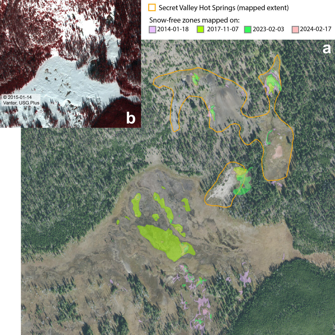
(a) NAIP (National Agriculture Imagery Program) natural-color aerial photograph of Secret Valley Hot Springs, in the backcountry between Norris Geyser Basin and Madison Junction, from September 25, 2015, showing snow-free zone mapping based on snowy wintertime imagery from multiple years. The mapped boundaries of the thermal area are indicated by the orange outlines. Areas with consistent thawing / bare ground across successive years exist within the thermal area boundary, as well as just south of the mapped thermal area. (b) Example of color infrared composite of a WorldView-2 image from January 14, 2015, that was used to map snow-free zones. Satellite images provided by Vantor (formerly Maxar Technologies) through their End User License Agreement via the NASA Commercial SmallSat Data Scientific Analysis (CSDSA) Program.
Sources/Usage
Public Domain.