
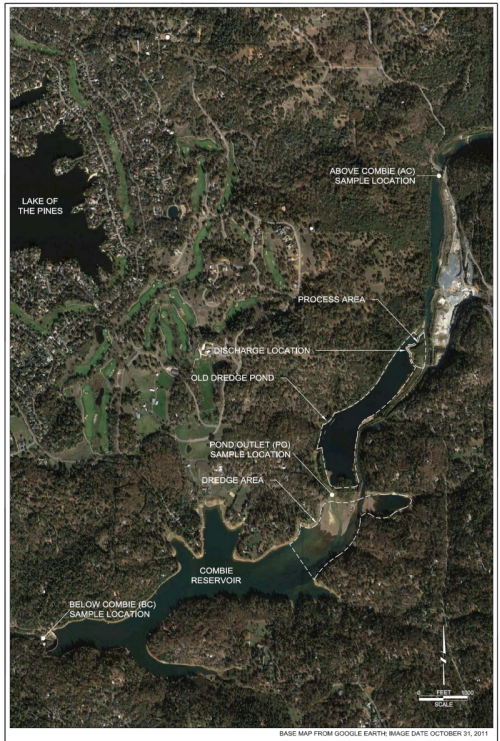
Satellite photo of Combie Reservoir
Detailed Description
Satellite photo (from Google Earth) showing locations of planned dredge area within Combie Reservoir, and sampling stations above and below the reservoir (from NID, 2012).
Sources/Usage
Public Domain.