
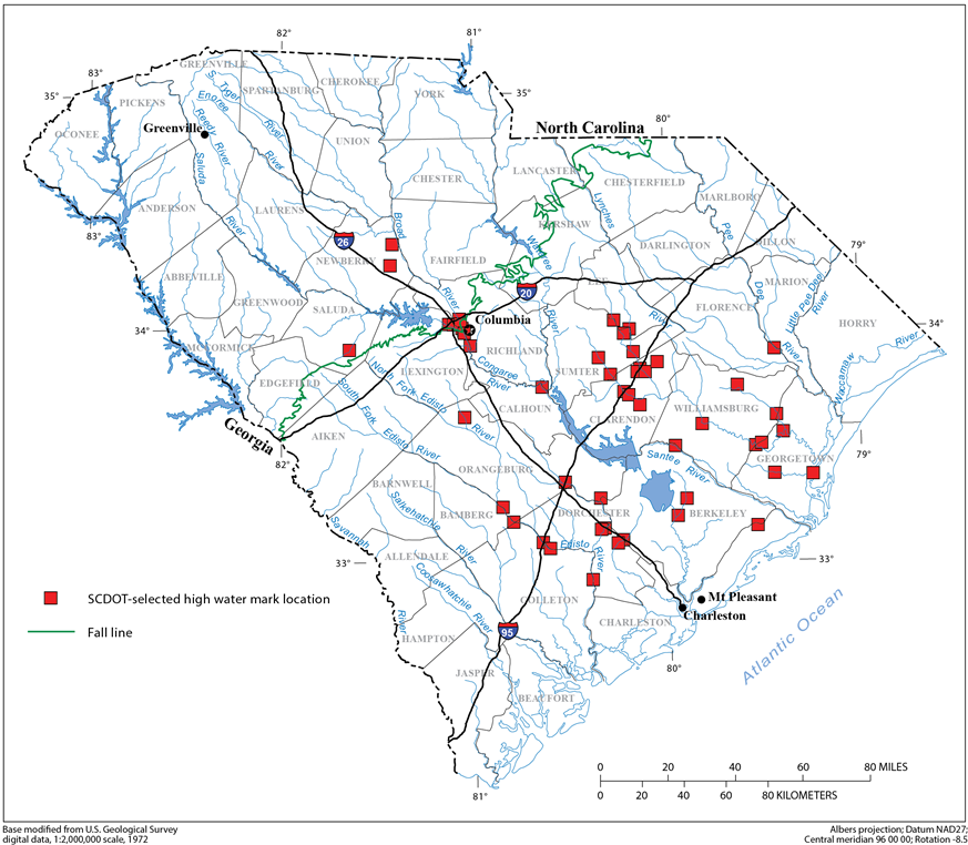
S.C. Department of Transportation-selected high-water mark locations.

Detailed Description
Selected Roadway High-Water Mark Data from Hurricane Joaquin Flooding, October 2015
As part of the statewide response to the flooding, the USGS and S.C. Department of Transportation (SCDOT) conducted a cooperative study to collect high-water mark (HWM) data at 50 selected road crossings (fig. 2). U.S. Geological Survey personnel visited each site to flag and survey HWMs.
Sources/Usage
Related

Selected Roadway High-Water Mark Data from Hurricane Joaquin Flooding, October 2015
As part of the statewide response to the flooding, the USGS and S.C. Department of Transportation (SCDOT) conducted a cooperative study to collect high-water mark (HWM) data at 50 selected road crossings. The HWM elevations and descriptive data have been posted on the USGS Short-Term Network (STN). The STN is a national-scale application and database designed to support USGS event-based sensor...
Related
Selected Roadway High-Water Mark Data from Hurricane Joaquin Flooding, October 2015
As part of the statewide response to the flooding, the USGS and S.C. Department of Transportation (SCDOT) conducted a cooperative study to collect high-water mark (HWM) data at 50 selected road crossings. The HWM elevations and descriptive data have been posted on the USGS Short-Term Network (STN). The STN is a national-scale application and database designed to support USGS event-based sensor...