
Aerial image of fissure 3 erupting on the Northeast Rift Zone of Mauna Loa on December 8, 2022. The eruption has built up a cone around the vent, which was 98 feet (30 meters) tall on December 7, 2022. USGS image by T. Orr.
Science Investments Focus on Landscape-scale Issues

Detailed Description
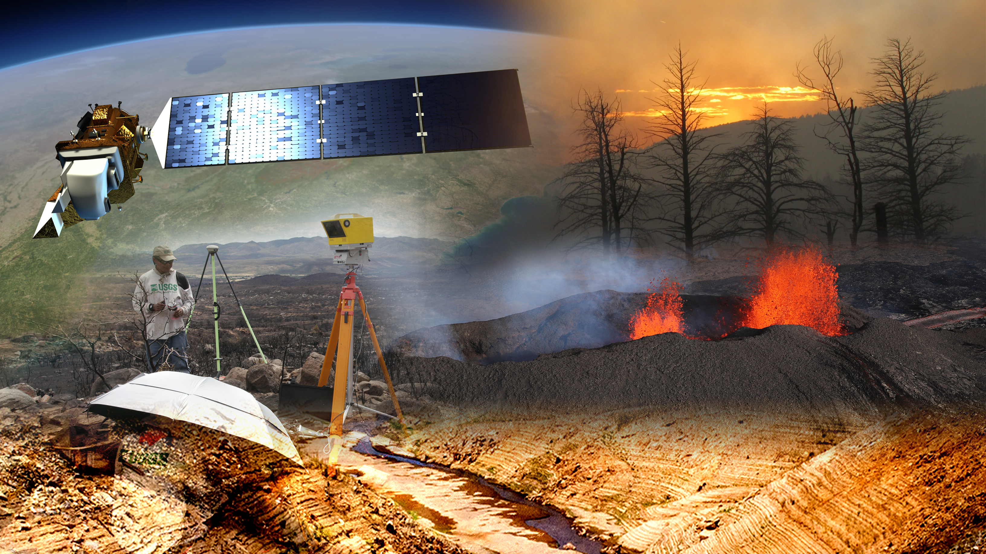
Science investments focus on landscape-scale issues, natural disasters and critical minerals while preparing tomorrow’s workforce.
Imagery included:
- Landsat: Artist concept of Landsat 8. Image Credit: NASA's Goddard Space Flight Center
- Scientists: USGS scientists Jeff Cordova and Fletcher Brinkerhoff set up the LiDAR and GPS equipment to survey a burned watershed within the Yarnell Hill Fire.
- Fire-sunset: Sunset as seen through the smoke of a prescribed burn in the Jemez Mountains, New Mexico. The burn was conducted to restore fire as an ecosystem process and reduce hazardous tree densities and fuel loads due to more than 100 years of fire suppression. Foreground trees (Douglas-fir and aspen) were killed during the Cerro Grande fire in 2000. Forest drought stress is strongly correlated with tree mortality from poor growth, bark beetle outbreaks, and high-severity fire.
- Drought: Lake Oroville showing extremely low water under the Enterprise Bridge during 2021 drought. Photo by Kelly M. Grow of the California Department of Water Resources.
- Volcano: Aerial image of fissure 3 erupting on the Northeast Rift Zone of Mauna Loa on December 8, 2022. The eruption has built up a cone around the vent, which was 98 feet (30 meters) tall on December 7, 2022. USGS image by T. Orr.
Sources/Usage
Public Domain.
Related

December 8, 2022 — Mauna Loa Fissure 3
Aerial image of fissure 3 erupting on the Northeast Rift Zone of Mauna Loa on December 8, 2022. The eruption has built up a cone around the vent, which was 98 feet (30 meters) tall on December 7, 2022. USGS image by T. Orr.

Oroville_2021drought.jpg
Lake Oroville showing extremely low water under the Enterprise Bridge during 2021 drought. Photo by Kelly M. Grow of the California Department of Water Resources.
Lake Oroville showing extremely low water under the Enterprise Bridge during 2021 drought. Photo by Kelly M. Grow of the California Department of Water Resources.

Artist concept of Landsat 8
Artist's concept of Landsat 8 orbting the Earth.
Image Credit: NASA Goddard Space Flight Center
Artist's concept of Landsat 8 orbting the Earth.
Image Credit: NASA Goddard Space Flight Center

LiDAR GPS Set Up Near Yarnell Fire
USGS scientists Jeff Cordova and Fletcher Brinkerhoff set up the LiDAR and GPS equipment to survey a burned watershed within the Yarnell Hill Fire.
USGS scientists Jeff Cordova and Fletcher Brinkerhoff set up the LiDAR and GPS equipment to survey a burned watershed within the Yarnell Hill Fire.

Prescribed Fire at Sunset in the Jemez Mountains, New Mexico
Prescribed Fire at Sunset in the Jemez Mountains, New MexicoSunset as seen through the smoke of a prescribed burn in the Jemez Mountains, New Mexico. The burn was conducted to restore fire as an ecosystem process and reduce hazardous tree densities and fuel loads due to more than 100 years of fire suppression. Foreground trees (Douglas-fir and aspen) were killed during the Cerro Grande fire in 2000.
Related
December 8, 2022 — Mauna Loa Fissure 3
Aerial image of fissure 3 erupting on the Northeast Rift Zone of Mauna Loa on December 8, 2022. The eruption has built up a cone around the vent, which was 98 feet (30 meters) tall on December 7, 2022. USGS image by T. Orr.
Aerial image of fissure 3 erupting on the Northeast Rift Zone of Mauna Loa on December 8, 2022. The eruption has built up a cone around the vent, which was 98 feet (30 meters) tall on December 7, 2022. USGS image by T. Orr.
Oroville_2021drought.jpg
Lake Oroville showing extremely low water under the Enterprise Bridge during 2021 drought. Photo by Kelly M. Grow of the California Department of Water Resources.
Lake Oroville showing extremely low water under the Enterprise Bridge during 2021 drought. Photo by Kelly M. Grow of the California Department of Water Resources.
Artist concept of Landsat 8
Artist's concept of Landsat 8 orbting the Earth.
Image Credit: NASA Goddard Space Flight Center
Artist's concept of Landsat 8 orbting the Earth.
Image Credit: NASA Goddard Space Flight Center
LiDAR GPS Set Up Near Yarnell Fire
USGS scientists Jeff Cordova and Fletcher Brinkerhoff set up the LiDAR and GPS equipment to survey a burned watershed within the Yarnell Hill Fire.
USGS scientists Jeff Cordova and Fletcher Brinkerhoff set up the LiDAR and GPS equipment to survey a burned watershed within the Yarnell Hill Fire.
Prescribed Fire at Sunset in the Jemez Mountains, New Mexico
Prescribed Fire at Sunset in the Jemez Mountains, New MexicoSunset as seen through the smoke of a prescribed burn in the Jemez Mountains, New Mexico. The burn was conducted to restore fire as an ecosystem process and reduce hazardous tree densities and fuel loads due to more than 100 years of fire suppression. Foreground trees (Douglas-fir and aspen) were killed during the Cerro Grande fire in 2000.