
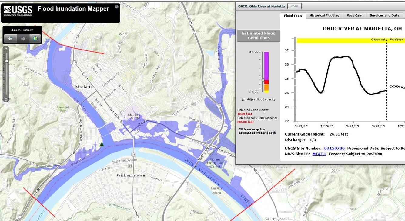
Screenshot of digital flood inundation map
Detailed Description
The USGS and National Weather Service recently created digital flood inundation maps for lower parts of the Muskingum River from Marietta, Ohio, to McConnelsville, and a reach of the Ohio River in southeast Ohio. These maps can help communities prepare for floods.