
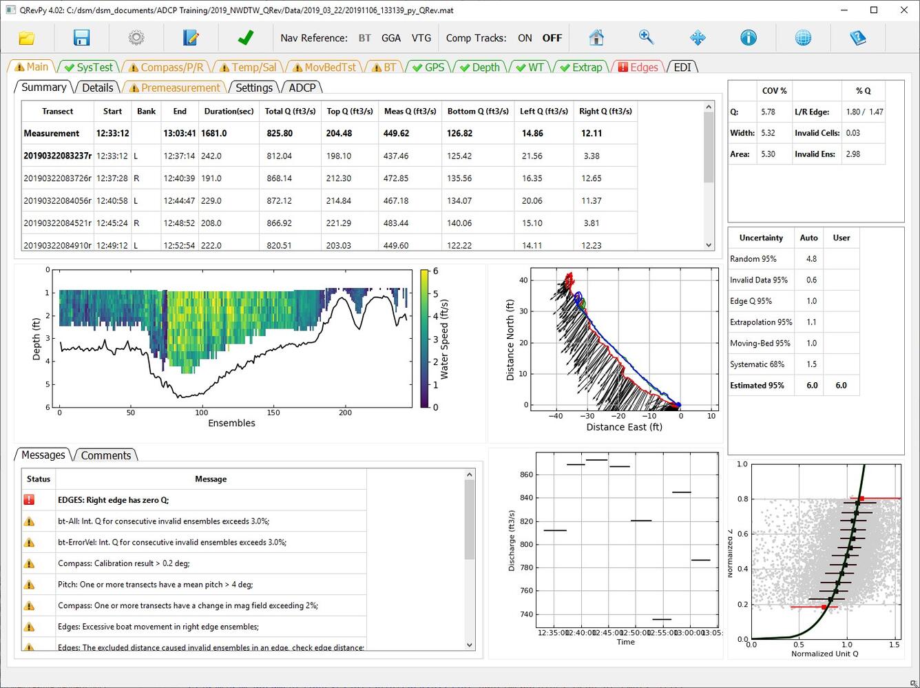
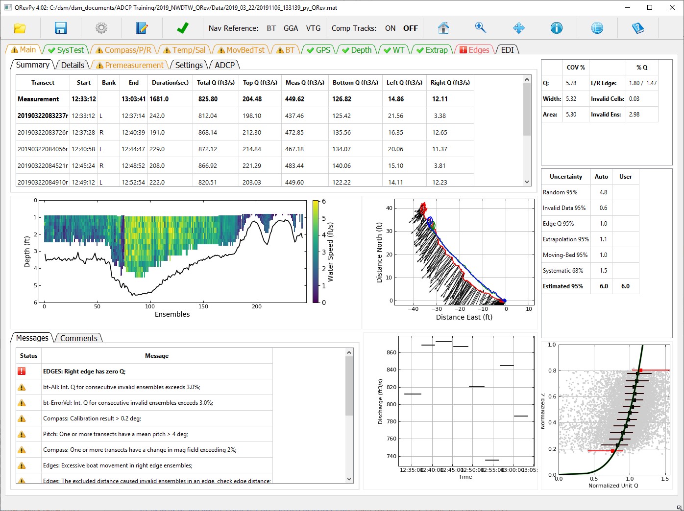
Screenshot of QRev 4 software
By Water Resources Mission Area
June 2020 (approx.)
Detailed Description
Screenshot of QRev software. QRev is a USGS-developed program that computes the discharge from a moving-boat ADCP measurement using data collected with any of the Teledyne RD Instrument (TRDI) or SonTek bottom tracking ADCPs.
Sources/Usage
Public Domain.