
Seafloor Flares at Grays Canyon
Detailed Description
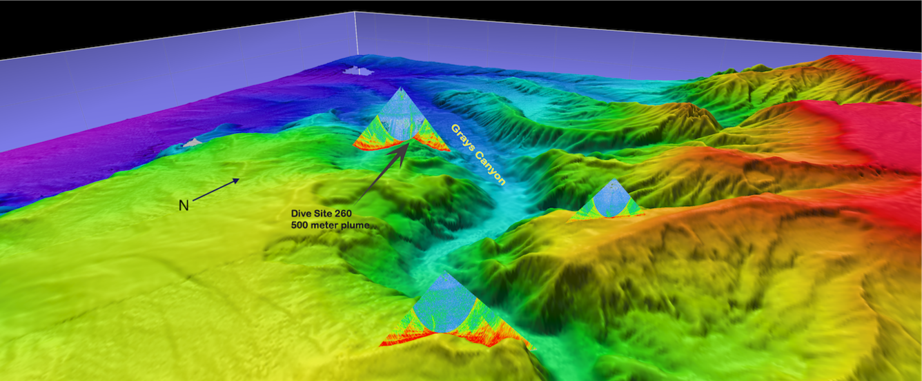
Methane seeps, called flares on the multibeam scanner, are superimposed on a bathymetric map of Grays Canyon, an undersea canyon off the Pacific Coast of Oregon and Washington. USGS scientist Bill Danforth creates these images to help the science crew decide where to dive with ROV SuBastian.
Sources/Usage
Public Domain.