
Seismic profile interpretations
By St. Petersburg Coastal and Marine Science Center
2017 (approx.)
Detailed Description
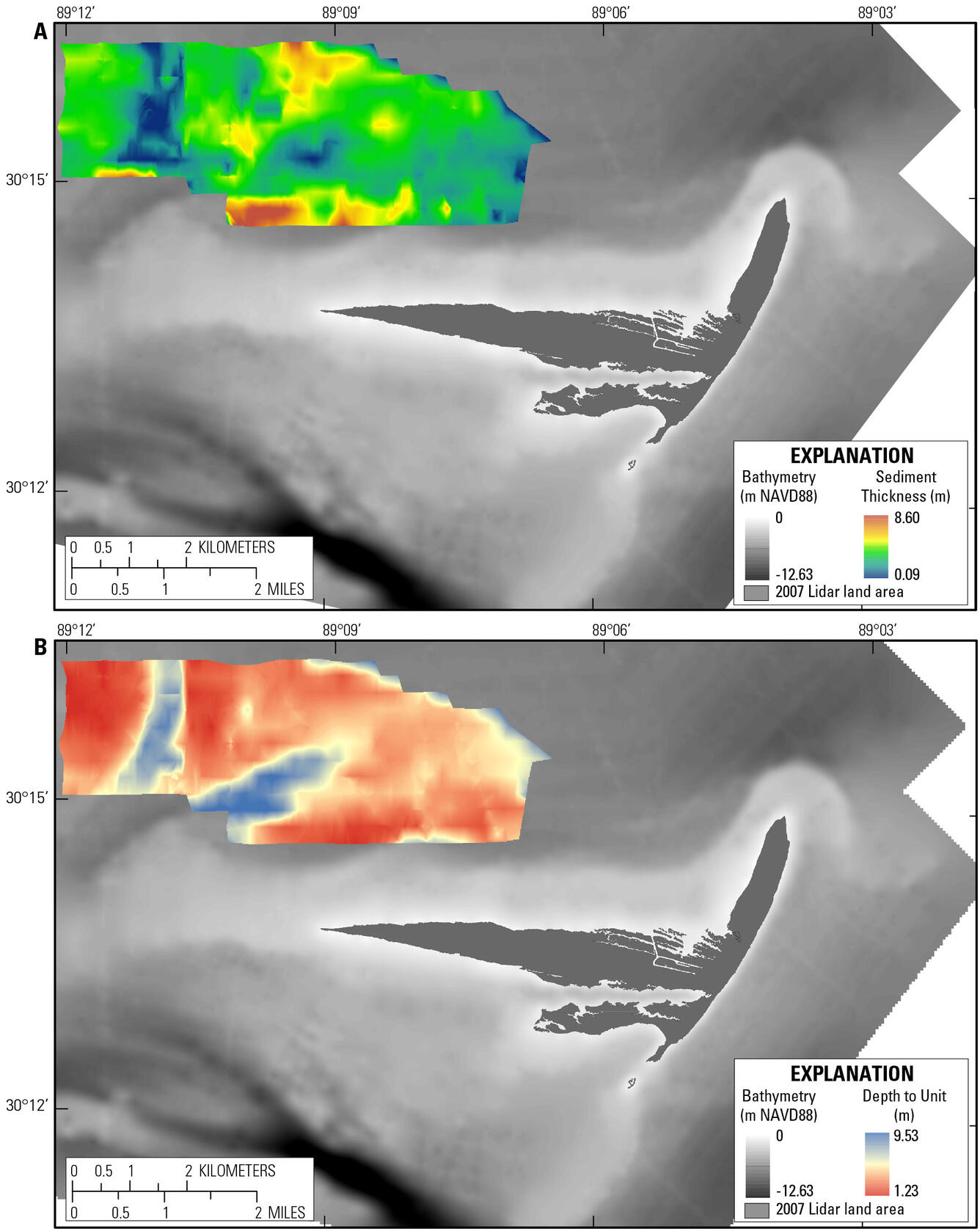
Seismic profile interpretations were used to produce isopach maps showing (a) the extent of the north lower sand (NLS) unit and unit thickness and (b) the depth to the top of the unit.
Sources/Usage
Public Domain.
Related

Geologic Evolution of Cat Island, Mississippi
The geologic evolution of Cat Island has been influenced by deltaic, lagoonal/estuarine, tidal, and oceanographic processes, resulting in a complex stratigraphic record.
Related
Geologic Evolution of Cat Island, Mississippi
The geologic evolution of Cat Island has been influenced by deltaic, lagoonal/estuarine, tidal, and oceanographic processes, resulting in a complex stratigraphic record.