
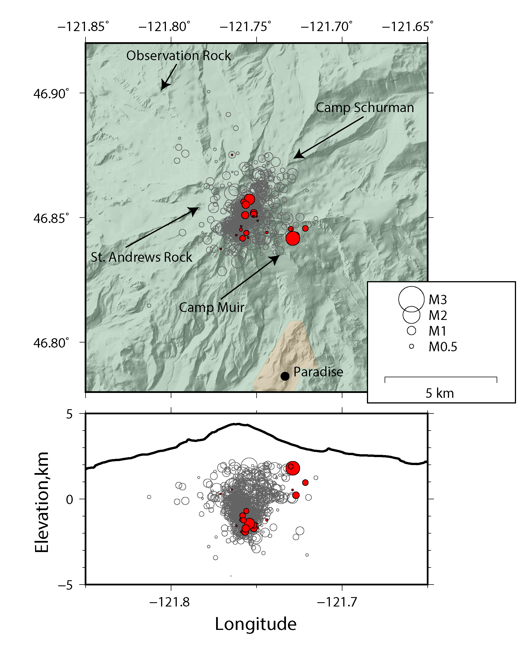
Seismic swarm at Mount Rainier Sep. 11-13, 2017.

Detailed Description
Top: Map view of well recorded historical seismicity at Mount Rainier since 2007 (gray circles) with seismicity since September 11 plotted as filled red circles. Location of seismic stations indicated by arrows. Bottom: Cross-sectional view looking north shows earthquake depths. Black outline is a west-east elevation profile of Mount Rainier. Circles are sized with respect to earthquake magnitude. Data are from the Pacific Northwest Seismic Network.
Sources/Usage
Public Domain.