
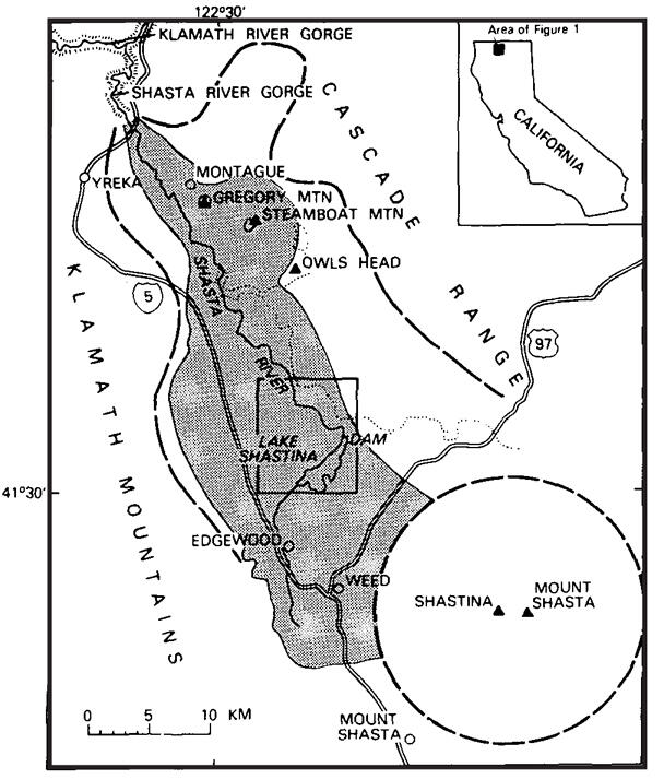
Sketch map of Shasta Valley debris-avalanche deposit (shaded).
By Volcano Hazards Program
1984 (approx.)
Detailed Description
Heavy dashed lines show approximate margins of Shasta Valley and base of Mount Shasta volcano; dotted line indicates western edge of Quaternary basalt.
Sources/Usage
Public Domain.
Crandell et. al., 1984
Related

Eruption History of Mount Shasta
Mount Shasta erupts episodically with ten or more eruptions occurring in short (500-2,000 year) time periods separated by long intervals (3,000-5,000 years) with few or no eruptions. Evidence suggests that magma most recently erupted at the surface about 3,200 years ago.
Related
Eruption History of Mount Shasta
Mount Shasta erupts episodically with ten or more eruptions occurring in short (500-2,000 year) time periods separated by long intervals (3,000-5,000 years) with few or no eruptions. Evidence suggests that magma most recently erupted at the surface about 3,200 years ago.