
Skilak Lake Seismograph Rescue Mission
Detailed Description
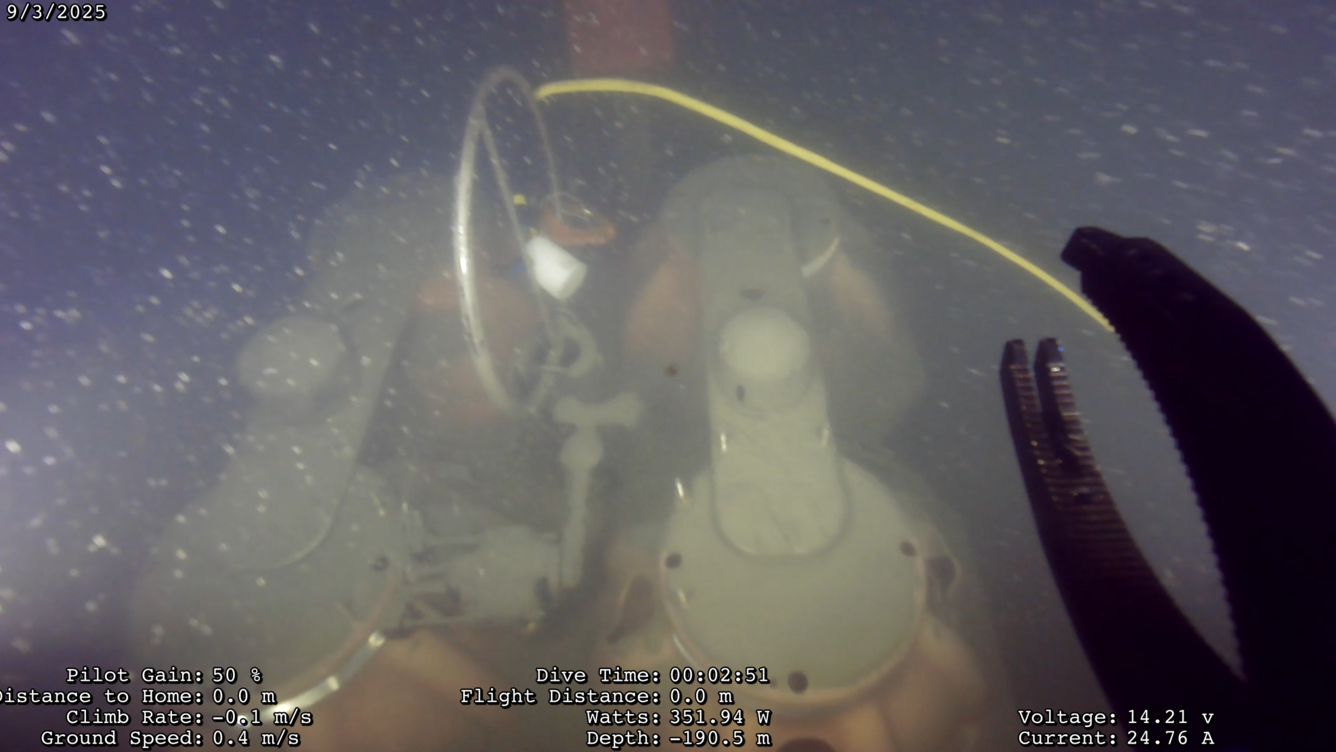
View from the remotely operated vehicle (ROV) after attaching a recovery line to the ocean bottom seismograph 190 meters deep in Skilak Lake, Alaska.
USGS researchers and partners from the Woods Hole Oceanographic Institution deployed 10 seismographs in and around Skilak Lake, Alaska in May 2024 to learn more about past seismic events. The research team returned about a year later in June 2025 to retrieve the seismographs using an acoustic pinger to trigger the instruments to detach from an anchor. All went smoothly, except one seismograph didn't resurface. In September, our scientists and a support team from Oregon State University's Ocean Observatories Initiative went back to Skilak Lake to attempt rescue with a remotely operated vehicle (an underwater tool used for scientific exploration). Using this tool, the team got a recovery line on the rogue instrument and successfully recovered it--along with a complete dataset! This completes the year long study of ground motion to better understand the area's paleoseismic record.
Read our story to learn more about this work and it's value.
Sources/Usage
Public Domain.