Woods Hole Coastal and Marine Science Center Newsletter: August-November 2025
Our Science Stories
-
Natural Disaster Preparedness Starts with Science Natural Disaster Preparedness Starts with Science
Whether you get updates about natural disasters from the news, a website, or an app, the accuracy of that information depends on the quality of the science behind it. The USGS provides the trusted scientific foundation that decision makers and communities rely on to prepare for coastal hazards.
-
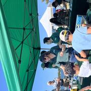
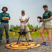
Woods Hole Science Stroll 2025 Woods Hole Science Stroll 2025
On August 9, 2025, the USGS and several other science organizations located in Woods Hole, Massachusetts, hosted hands-on activities and informative displays for the annual Woods Hole Science Stroll.
-
Sound Waves Newsletter: August-November 2025 Sound Waves Newsletter: August-November 2025
In this issue, read stories about natural disaster preparedness, seafloor mapping, coastal modeling, glacial flooding, and much more.
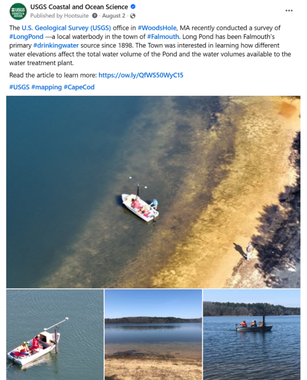
Social Media Corner
Some of our most popular posts from the past few months.
Publications and Data Releases
Publications
O’Neill, A.C., Batiste, S.F., Buscombe, D.D., Burgess, J., Doran, K.S., Gibbs, A.E., Henderson, R.E., Heslin, J.L., Janda, C.N., Lundine, M.A., Terrano, J.F., Warrick, J.A., and Weber, K.M., 2025, Comparisons of shoreline positions from satellite-derived and traditional field- and remote-sensing techniques: U.S. Geological Survey Open-File Report 2025–1054, 41 p., https://doi.org/10.3133/ofr20251054.
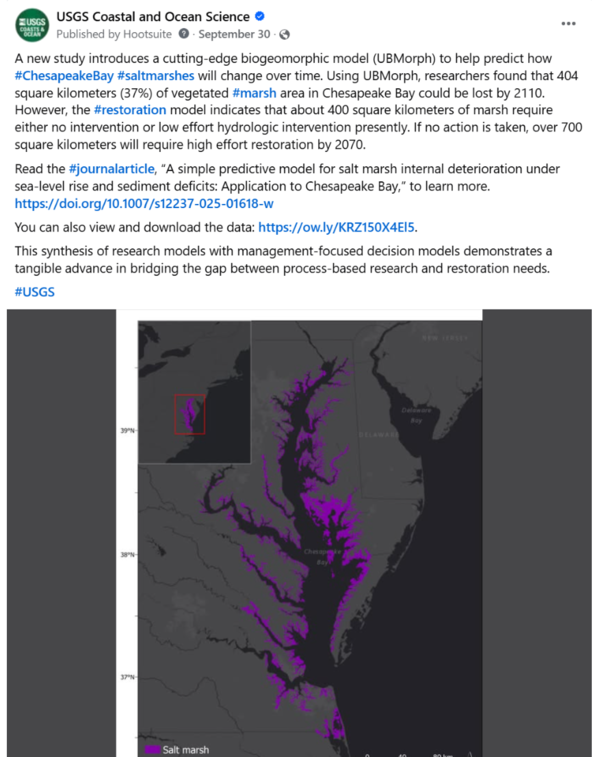
Ganju, N.K., Ackerman, K., Defne, Z., Mariotti, G., Curson, D., Posnik, Z., Carr, J., and Grand, J., 2025, A simple predictive model for salt marsh internal deterioration under sea-level rise and sediment deficits: Application to Chesapeake Bay: Estuaries and Coasts, Volume 48, article number 178, https://doi.org/10.1007/s12237-025-01618-w.
Padilla, A.M., Pardis, W., Kapit, J., Bjorklund, T.A., Ward, N.D., Fornari, D.J., Hautala, S., Waite, W.F., Johnson, H.P., and Michel, A.P.M., 2025, Spatial mapping of dissolved methane using an in situ sensor in Puget Sound: Limnology and Oceanography, Volume 23, Issue 11, https://doi.org/10.1002/lom3.10717.
Data Releases
Over, J.R., Brosnahan, S.M., Cramer, J.M., Sherwood, C.R., and Traykovski, P.A., 2025, Topographic and bathymetric data, aerial imagery, and GPS data collected during UxS operations at Marconi Beach, Cape Cod National Seashore, Massachusetts between September 2024 and March 2025: U.S. Geological Survey data release, https://doi.org/10.5066/P1Z9NCQX.
De Meo, O.A., Suttles, S.E., Marsjanik, E.D., Bales, R.D., and Sherwood, C.R., 2025, Grain-size analysis of sediment samples collected in the nearshore zone offshore of Marconi Beach, Wellfleet, MA, December 9, 2024: U.S. Geological Survey data release, https://doi.org/10.5066/P14KORS8.
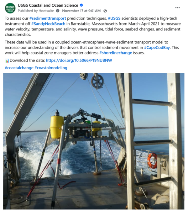
Suttles, S.E., De Meo, O.A., Bales, R.D., and Warner, J.C., 2025, Time-series measurements of oceanographic and seabed response data collected in Cape Cod Bay, Barnstable, MA, March 10 to April 7, 2021: U.S. Geological Survey data release, https://doi.org/10.5066/P19NUBNW.
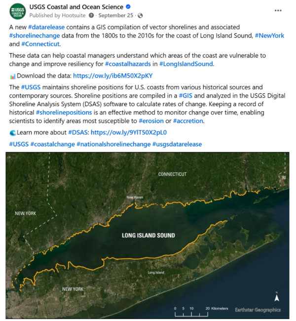
Henderson, R.E., Kratzmann, M., Farris, A., Lentz, E., and Himmelstoss, E., 2025, National Shoreline Change—A GIS compilation of vector shorelines and associated shoreline change data from the 1800s to the 2010s for the coast of Long Island Sound, New York and Connecticut: U.S. Geological Survey data release, https://doi.org/10.5066/P1TKEDFX.
Ganju, N.K., Ackerman, K.V., and Defne, Z., 2025, Projections of vegetated area and vegetated plain elevation in Chesapeake Bay salt marsh units: U.S. Geological Survey data release, https://doi.org/10.5066/P1ASOF7N.
Fieldwork Highlights
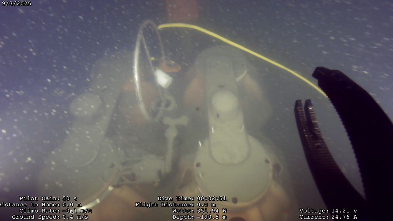
Skilak Lake Seismograph Rescue Mission
USGS researchers and partners from the Woods Hole Oceanographic Institution deployed 10 seismographs in and around Skilak Lake, Alaska in May 2024 to learn more about past seismic events. The research team returned about a year later in June 2025 to retrieve the seismographs using an acoustic pinger to trigger the instruments to detach from an anchor. All went smoothly, except one seismograph didn't resurface. In September, our scientists and a support team from Oregon State University's Ocean Observatories Initiative went back to Skilak Lake to attempt rescue with a remotely operated vehicle (an underwater tool used for scientific exploration). Using this tool, the team got a recovery line on the rogue instrument and successfully recovered it--along with a complete dataset! This completes the year long study of ground motion to better understand the area's paleoseismic record. Read our story to learn more about this work and it's value.
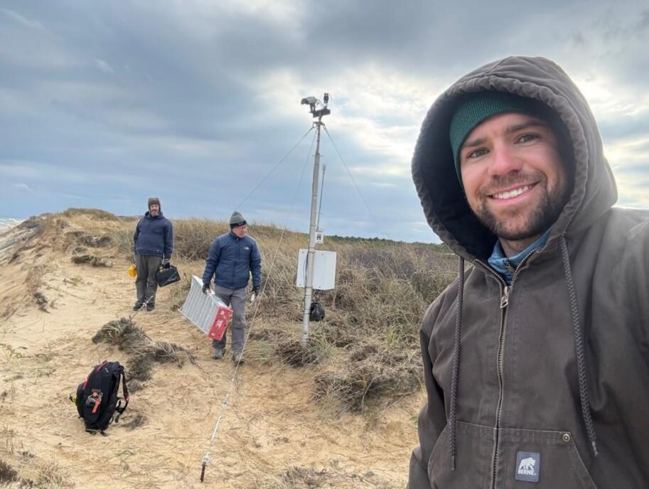
CoastCam Maintenance of Marconi Beach
The USGS uses a nationwide network of coastal observing cameras (CoastCams) to monitor coastal conditions in near real-time and support research on a variety of coastal processes and hazards. The data are used to evaluate and improve the real-time forecasts made in the Total Water Level and Coastal Change Forecast Viewer. Since 2021, USGS scientists have worked collaboratively with Cape Cod National Seashore to maintain a CoastCam station at Marconi Beach in Wellfleet, Massachusetts. The cameras are located on the edge of a 20-meter high buff. The bluff has been eroding at a long-term rate of about 2-meters per year, however, in recent years it has retreated as much as 10-meters. The cameras are moved in accordance with the bluff erosion as needed, and in late November, it was time to move them for the third time. Whenever the USGS team moves the cameras, they need to determine the new location and look direction. They do this by placing targets in the field of view, surveying the target locations, and conducting photogrammetry.
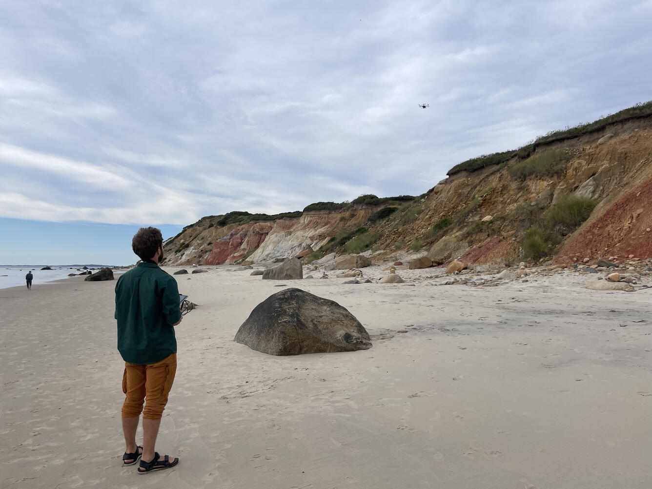
High-Resolution Mapping of the Sacred Gay Head Cliffs
The USGS Aerial Imaging and Mapping Group (AIMG) collaborated with the Wampanoag Tribe of Gay Head (Aquinnah), the Town of Aquinnah, and the Aquinnah Police Department to collect high-resolution data of the Gay Head Cliffs. With permission from the Tribe, the AIMG used uncrewed aircraft systems to document the cliffs in detail to better understand their geologic past, present, and future. The cliffs are sacred and not publicly accessible, so a Tribal representative accompanied the AIMG throughout the data-collection process--ensuring all protocols were followed and work was conducted with respect for the cultural and environmental significance of the site.
Other Activities
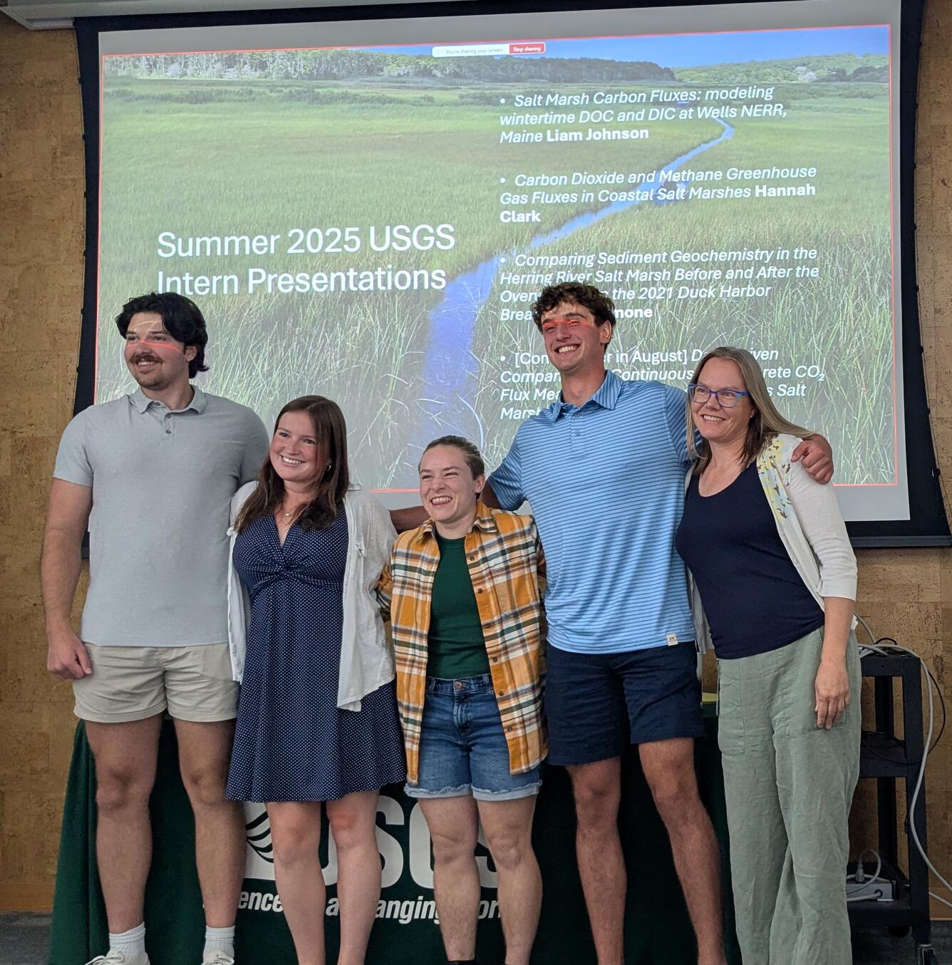
Summer 2025 Internship Presentations
In August, we had four great presentations from our summer interns discussing various aspects of salt marsh science! They each worked with Meagan Eagle, a research physical scientist who regularly mentors interns and early career scientists--helping them gain valuable experience, advance skills, and build a network within the scientific community in Woods Hole, Massachusetts.