
Small-scale map of Kīlauea's ERZ flow field
Detailed Description
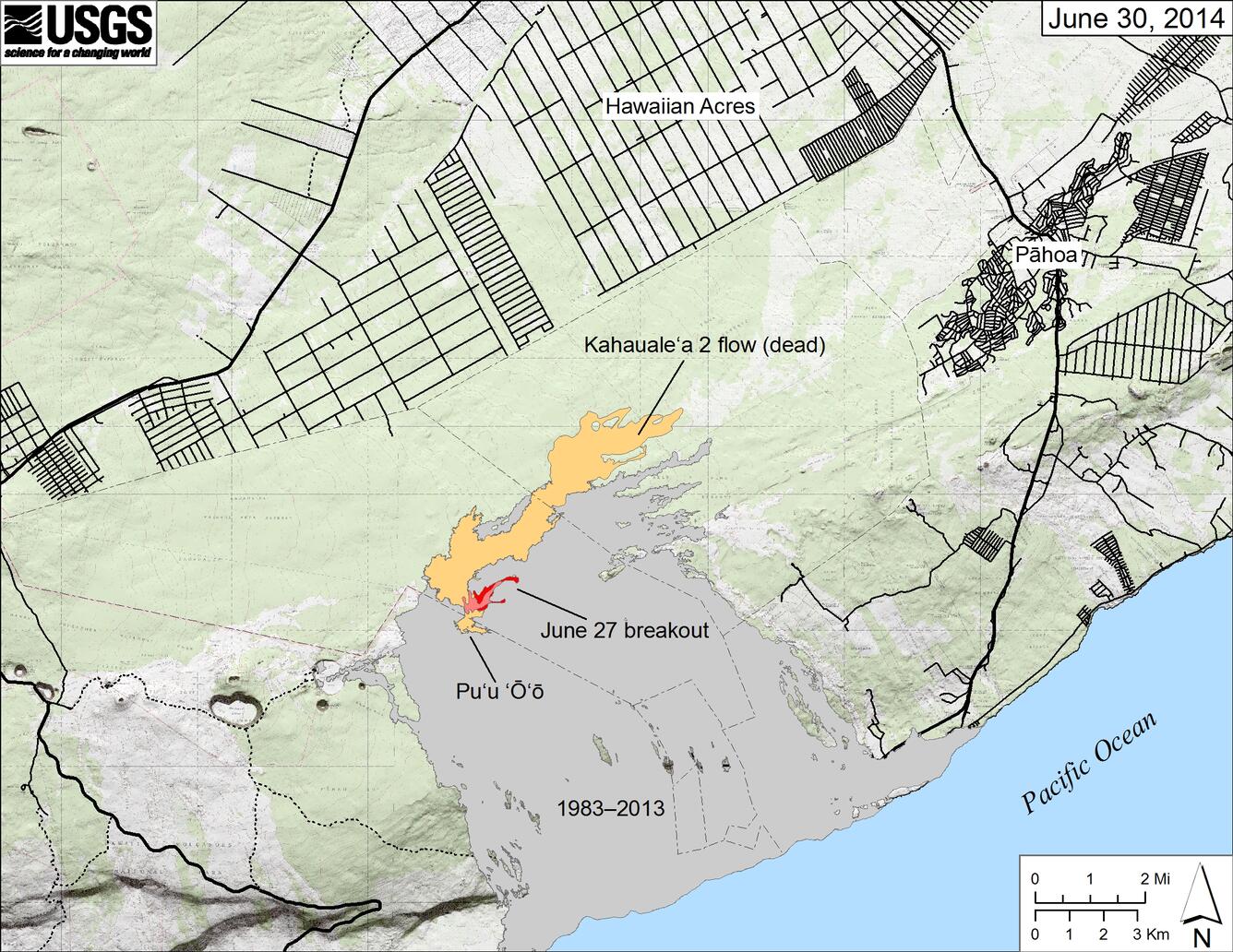
Map showing the June 27, 2014, breakout and the Kahauale‘a 2 flow in relation to the eastern part of the Island of Hawai‘i as of June 30, 2014. The Kahauale‘a 2 flow (pale orange) is no longer active — it was beheaded when the lava level at Pu‘u ‘Ō‘ō dropped with the onset of the June 27 breakout. The area of the new flow as mapped on June 27 is shown in pink, while widening of the flow as June 30 is shown in red. All older lava flows (1983-2013) are shown in gray.
Sources/Usage
Public Domain.