
Social media for CRL model
By Woods Hole Coastal and Marine Science Center
July 2025 (approx.)

Detailed Description
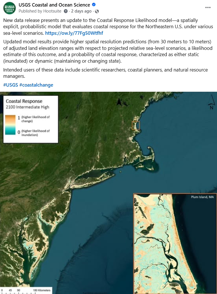
New data release presents an update to the Coastal Response Likelihood model—a spatially explicit, probabilistic model that evaluates coastal response for the Northeastern U.S. under various sea-level scenarios. https://doi.org/10.5066/P13JKJUT
Updated model results provide higher spatial resolution predictions (from 30 meters to 10 meters) of adjusted land elevation ranges with respect to projected relative sea-level scenarios, a likelihood estimate of this outcome, and a probability of coastal response, characterized as either static (inundated) or dynamic (maintaining or changing state).
Intended users of these data include scientific researchers, coastal planners, and natural resource managers.
Sources/Usage
Public Domain.