
Space-based triangulation procedure
Detailed Description
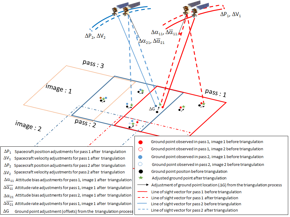
A pictorial representation of the space-based triangulation procedure. The orbital tracks prior to the triangulation for the two passes, pass 1 and pass 2, are shown in solid red and blue curves, respectively. The corresponding dotted lines (red, blue) denote the orbital track after the triangulation procedure. The solid red and blue line-of-sight vectors from the spacecraft to the ground represent the viewing geometry of a specific ground point observed in the image, prior to the triangulation process. The adjusted line-of-sight vectors to the ground point after the triangulation are denoted by dotted lines. The pre-triangulated positions of the ground points are shown in black dots, and their corresponding locations estimated from the spacecraft’s pre-adjustment attitude and ephemeris are shown by red and blue dots for pass 1 and pass 2, respectively. The same points in image 2 are shown as red and blue circles for passes 1 and 2, respectively. The green stars represent the triangulated positions of the ground points, and the black arrows indicate the positional offsets (ΔG) for the ground points after triangulation.
Sources/Usage
Public Domain.