
Steps in making a land use and land cover map using the RLCM Tool
By Earth Resources Observation and Science (EROS) Center
2016 (approx.)
Detailed Description
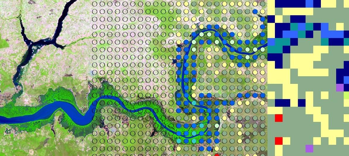
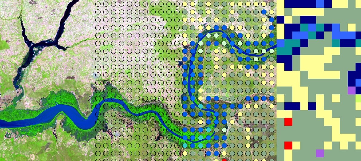
Steps in making a land use and land cover map using the RLCM Tool; 1) selecting imagery, 2) overlaying a grid of points, 3) interpreting and attributing, and 4) making land use and land cover map.
Sources/Usage
Public Domain.
Related

Landscapes of West Africa: A Window on a Changing World
Landscapes of West Africa: A Window on a Changing World is an atlas and unique dataset that uses time-series satellite image data and field-based photography to tell the story of wide-ranging land change across 17 countries. EROS scientists selected the years 1975, 2000 and 2013 to characterize the landscapes and create the product, which represents the broadest effort to map the region in history...
Related
Landscapes of West Africa: A Window on a Changing World
Landscapes of West Africa: A Window on a Changing World is an atlas and unique dataset that uses time-series satellite image data and field-based photography to tell the story of wide-ranging land change across 17 countries. EROS scientists selected the years 1975, 2000 and 2013 to characterize the landscapes and create the product, which represents the broadest effort to map the region in history...