U.S. flag

An official website of the United States government

International Programs

The USGS Office of International Programs helps facilitate and coordinate USGS science with diverse partners, including other federal agencies, international institutions, and foreign governments. USGS international activities support U.S. foreign policy and science diplomacy, and improve characterization and management of ecosystems and natural resources worldwide.

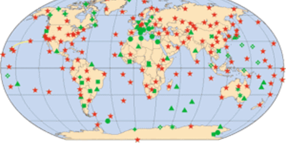
The U.S. Geological Survey Office of International Programs is dedicated to high quality, timely, scientific study that is international in scope and that focuses on the USGS Science Strategy's goals. USGS/OIP helps facilitate and coordinate USGS science with diverse partners, whether they be U.S. Federal agencies or foreign governments, concerned about the natural hazards that threaten lives and livelihoods; the water, energy, minerals, and other natural resources we rely on; the integrity of ecosystems and environment; and the impacts of climate and land-use change. For more about the benefits provided by USGS/OIP, read how USGS accomplishes the international mission.

A Changing World

Over the coming decades, profound environmental and societal trends will challenge governments, administrators, and societies with increasingly complex policy decisions. Preparing for these changes will require reliable data and information that are inherently global in nature and need international collaboration in order to make scientific progress. To address these needs, USGS/OIP has historically engaged in countries and regions where the geopolitical landscape is challenging, bringing capacities such as Earth system modeling, operational forecasts, emerging technologies, advanced observing and sensing systems, and state-of-the-art information-management systems to provide proactive and on-demand integrated, dynamic, and responsive information.


Información en español 

Si desea saber más acerca de las capacidades científicas y técnicas del Servicio Geológico de los Estados Unidos de América y los contactos correspondientes dentro de la Oficina de Programas Internacionales, apriete aquí.


News

link

USGS Student Intern Amber Kremer Wins AmeriGEO Individual Excellence Award

link

USGS Advises on Sediment and Erosion Monitoring as Part of Emergency Response in Ecuador

link

USGS Office of International Programs team reconnaissance trip to Itaipu Binacional, Brazil and Paraguay

Publications

Stakeholder attitudes and perspectives on wildlife disease surveillance as a component of a One Health approach in Thailand

Coordinated wildlife disease surveillance (WDS) can help professionals across disciplines effectively safeguard human, animal, and environmental health. The aims of this study were to understand how WDS in Thailand is utilized, valued, and can be improved within a One Health framework. An online questionnaire was distributed to 183 professionals (55.7% response rate) across Thailand working in wil
Authors
Serena Elise George, Moniek Smink, Nareerat Sangkachai, Anuwat Wiratsudakul, Walasinee Sakcamduang, Sarin Suwanpakdee, Jonathan M. Sleeman

Satellite precipitation bias estimation and correction using in situ observations and climatology isohyets for the MENA region

The availability of reliable gridded precipitation datasets is limited around the world, especially in arid regions. In this study, we utilized observations from satellite-based precipitation data and in situ rain gauge observations to determine a suitable precipitation dataset in the Middle East & North Africa (MENA) region. First, we evaluated seven different precipitation products using rain ga
Authors
Stefanie Kagone, Naga Manohar Velpuri, Kul Bikram Khand, Gabriel B. Senay, Michael R. Van der Valk, Daniel J. Goode, Salam Abu Hantash, Thair M. Al-Momani, Nanor Momejian, Jack R. Eggleston

Advances in transboundary aquifer assessment

This Special Issue is intended to highlight both recent work to advance the physical understanding of transboundary aquifers and factors relevant in successful collaboration on transboundary groundwater resource use. The collected papers address: (1) the identification and prioritization of the needs and strategies for sustainable groundwater development and use, along with the complexities introd
Authors
Anne-Marie Matherne, Sharon B. Megdal

Science

Stakeholder Engagement for Natural Hazards Investigations in the Caribbean (SENHIC)

USGS staff are connecting with natural hazards researchers based in the Caribbean and those specializing in the region to find out which natural hazards are of primary concern, learn about their mitigation efforts, and explore the potential for research collaboration.
link

Stakeholder Engagement for Natural Hazards Investigations in the Caribbean (SENHIC)

USGS staff are connecting with natural hazards researchers based in the Caribbean and those specializing in the region to find out which natural hazards are of primary concern, learn about their mitigation efforts, and explore the potential for research collaboration.
Learn More

Ecosystems Science for a Changing World

USGS science products help achieve sustainable management and conservation of fish and wildlife resources in wild, rural, and urban spaces. This includes programs in climate and environmental change; effects of management actions on communities, lands and waters, and species; and risks and solutions to harmful invasive species, wildlife diseases, and contaminants in the environment. USGS provides...
link

Ecosystems Science for a Changing World

USGS science products help achieve sustainable management and conservation of fish and wildlife resources in wild, rural, and urban spaces. This includes programs in climate and environmental change; effects of management actions on communities, lands and waters, and species; and risks and solutions to harmful invasive species, wildlife diseases, and contaminants in the environment. USGS provides...
Learn More

Geospatial Science for a Changing World

USGS maintains its core strengths in characterizing and understanding complex Earth and biological systems through research; modeling; highly accurate topographic, geologic, hydrographic, and biogeographic maps; and delivery of high-quality earth observation data. Programs include cooperative data collection systems, cross-boundary synthesis, and scientific data delivery for users worldwide. USGS...
link

Geospatial Science for a Changing World

USGS maintains its core strengths in characterizing and understanding complex Earth and biological systems through research; modeling; highly accurate topographic, geologic, hydrographic, and biogeographic maps; and delivery of high-quality earth observation data. Programs include cooperative data collection systems, cross-boundary synthesis, and scientific data delivery for users worldwide. USGS...
Learn More