
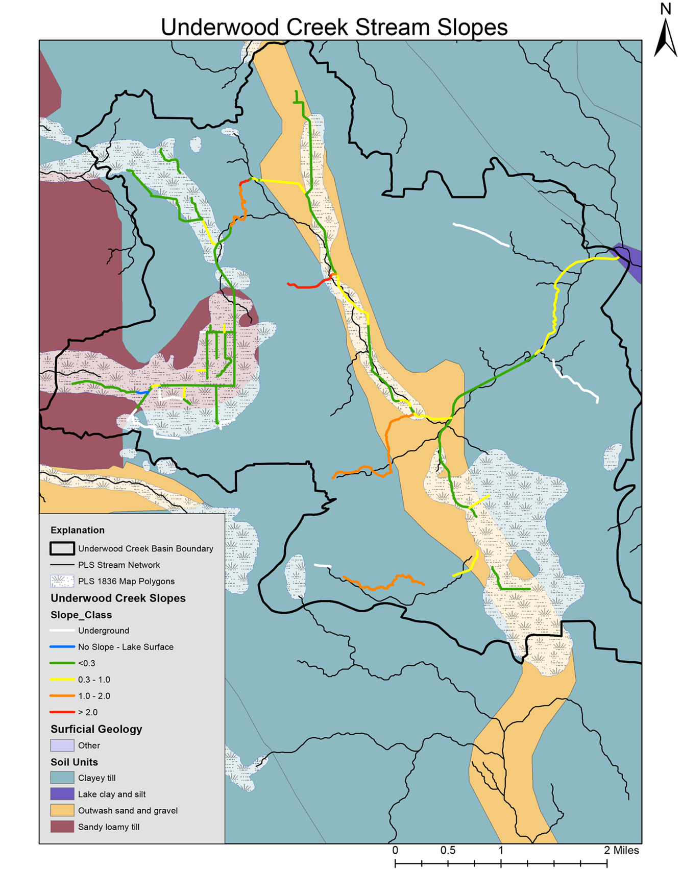
Stream slopes of Underwood Creek, Wis.
Detailed Description
Map showing overlays of stream slope, surficial geology, and pre-EuroAmerican settlement 1836 Public Land Survey (PLS) streams and wetlands for Underwood Creek, Wis.
Data citations:
Original vegetation: Wisconsin Department of Natural Resources, 2017
Original vegetation polygons: Wisconsin Deparptment of Natural Resources, Madison, WI.
https://www.arcgis.com/sharing/rest/content/items/3e952715b0d549c39cd8e26b4b274a0c/info/metadata/metadata.xml?format=default&output=html, 1:500, 000 scale
Slopes from Milwaukee County lidar-based DEM: Milwaukee County Land Information Office, 2010, Coutnywide LiDAR 5ft DEM Smoothed: https://county.milwaukee.gov/EN/Administrative-Services/Land-Information-Office/GIS-Data/Data-Download-Form
Surficial geology: WDNR, 2011, Surficial Deposits, in Ecological Landscapes of Wisconsin Handbook 1805.1, https://dnr.wi.gov/topic/landscapes/documents/StateMaps/Map_S12_Surficial_Deposits.pdf scale 1:500,000.
Streams: WDNR, 2008, Rivers and streams hydrography, 1:24,000 scale, :http://dnr.wi.gov/maps/gis/datahydro.html
Sources/Usage
Public Domain.