
StreamStats for Georgia - Analytical tools for water-resources planning
Detailed Description
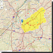
StreamStats is a Web-based Geographic Information Systems (GIS) application that provides users with access to an assortment of analytical tools that are useful for a variety of water-resources planning and management purposes, and for engineering and design purposes. StreamStats users can select USGS data-collection station locations shown on a map and obtain previously published information for the stations. Users also can select any location along a stream and obtain the drainage-basin boundary, basin characteristics, and estimates of streamflow statistics for the location. The streamflow statistics that StreamStats can provide for data-collection stations and for user-selected ungaged sites vary among the implemented states and among data-collection stations within states