
Sturgeon Bend in the San Joaquin
Detailed Description
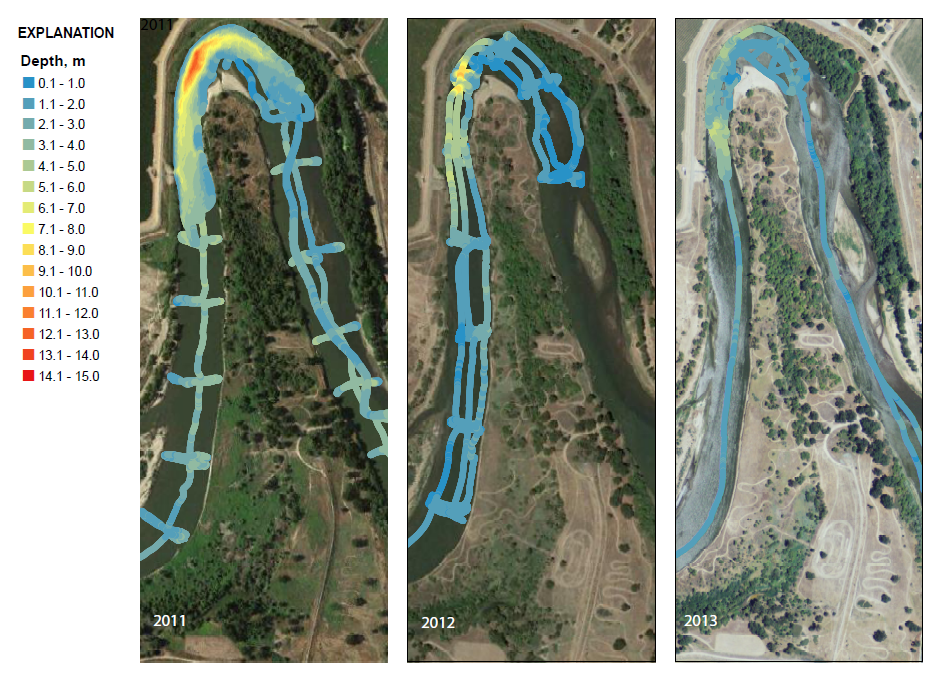
Figure showing changes in depth at "Sturgeon Bend" in the San Joaquin River (upstream of the USGS gage at Vernalis) between 2011 and 2013. Although streamflow discharge is lower in 2012 and 2013, significant aggradation has been observed.
Sources/Usage
Public Domain.
Related

Mapping Sturgeon Spawning Habitat in the Lower San Joaquin River
The spawning of adult white sturgeon ( Acipenser transmontanus) in the lower San Joaquin River was documented recently by the United States Fish and Wildlife Service (USFWS) (Gruber and others, 2012; Jackson and Eenennaam, 2013). Streamflow on the San Joaquin River has been modified by State and Federal water project operations, and there are a variety of questions regarding the effects on fish...
Related
Mapping Sturgeon Spawning Habitat in the Lower San Joaquin River
The spawning of adult white sturgeon ( Acipenser transmontanus) in the lower San Joaquin River was documented recently by the United States Fish and Wildlife Service (USFWS) (Gruber and others, 2012; Jackson and Eenennaam, 2013). Streamflow on the San Joaquin River has been modified by State and Federal water project operations, and there are a variety of questions regarding the effects on fish...