
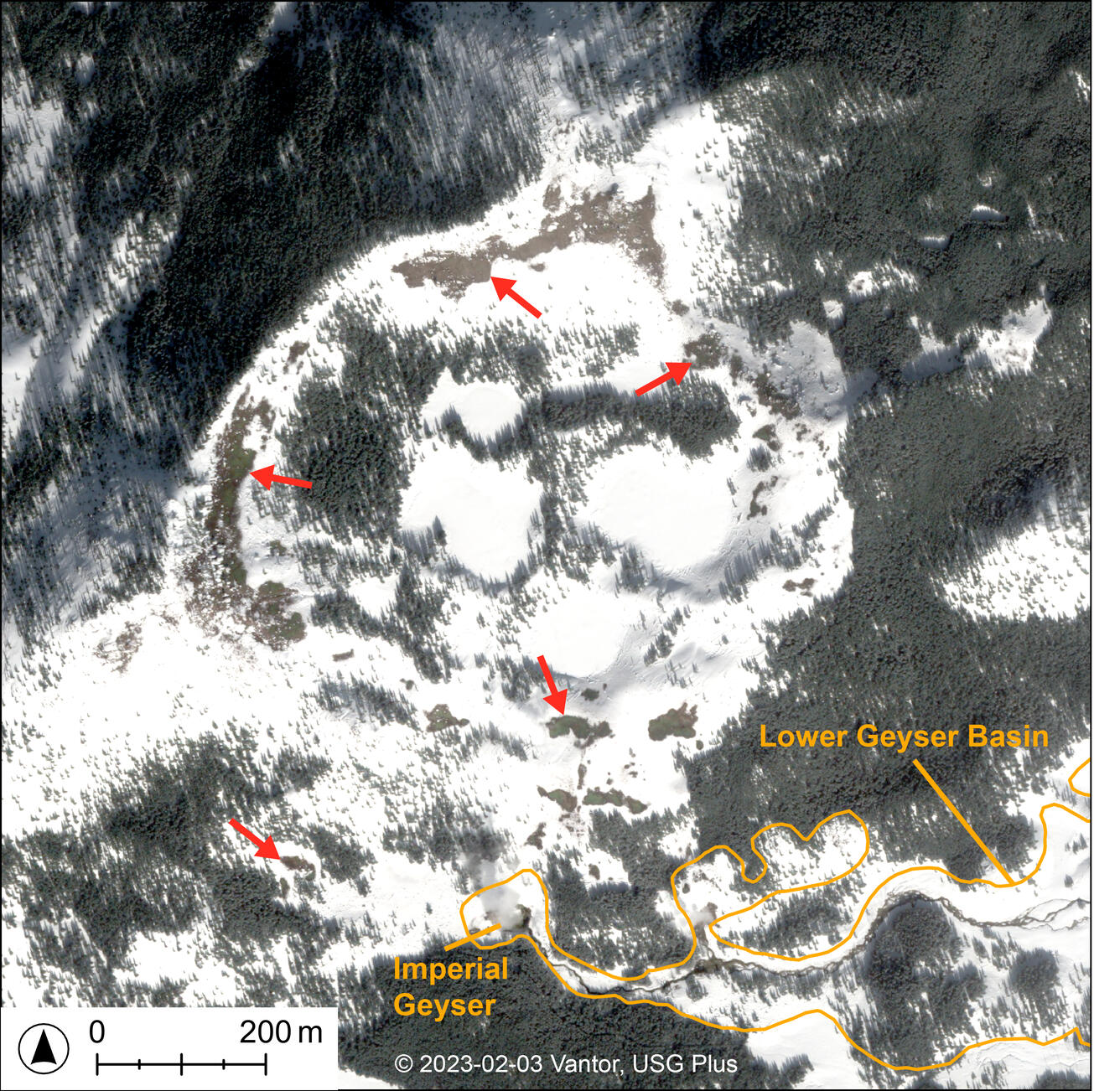
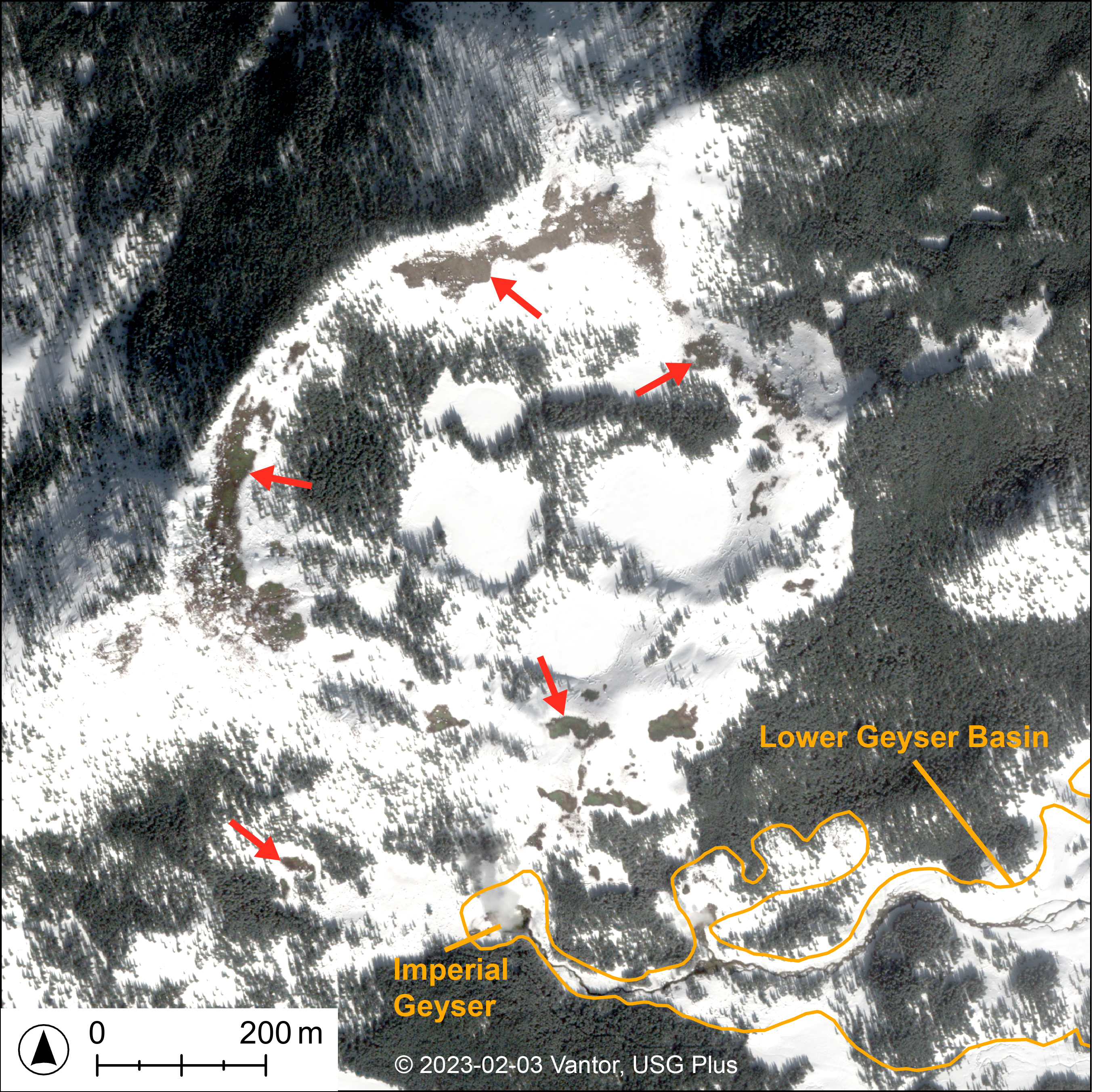
Subtle thermal ground revealed by wintertime satellite imagery of Twin Buttes, Yellowstone National Park
Detailed Description
WorldView-2 natural-color satellite image from February 3, 2023, showing snow-free zones around Twin Buttes, just beyond the southwest portion of Lower Geyser Basin. At the time and date this image was acquired, there was extensive snow cover (29 inches of snowpack, with the last snowfall in this area occurring on January 29, 2023). The numerous snow-free zones (indicated by red arrows) are interpreted as areas where the ground was too warm for snow to accumulate, and thus likely to be thermal ground. Satellite image provided by Vantor (formerly Maxar Technologies) through their End User License Agreement via the NASA Commercial SmallSat Data Scientific Analysis (CSDSA) Program.
Sources/Usage
Public Domain.