
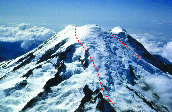
Summit of Mount Rainier viewed toward the SW. The dashed red lines...
By Volcano Hazards Program
2012 (approx.)
Detailed Description
Summit of Mount Rainier viewed toward the southwest. The dashed red lines trace the 5,600 year old Osceola collapse crater now mostly filled in by lava flows.
Sources/Usage
Public Domain.
Related

Landslides and Rockfalls Can Trigger Lahars at Mount Rainier
The combination of weak, hydrothermally altered rocks, large quantities of snow and ice, and a seismically active volcano make landslides and rockfalls potential hazards at Mount Rainier.
Related
Landslides and Rockfalls Can Trigger Lahars at Mount Rainier
The combination of weak, hydrothermally altered rocks, large quantities of snow and ice, and a seismically active volcano make landslides and rockfalls potential hazards at Mount Rainier.