
Thermal map of fissure system and lava flows

Detailed Description
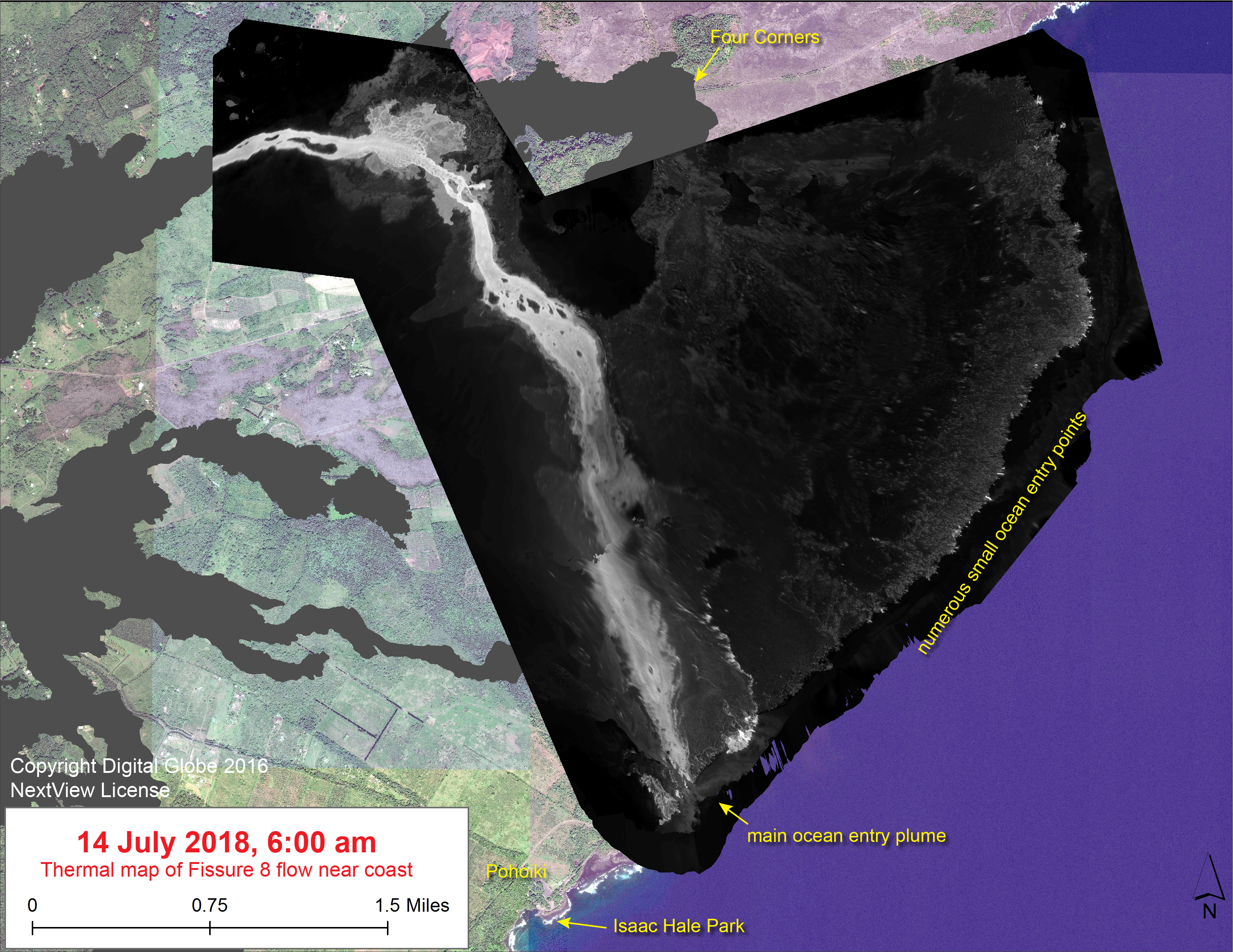
This thermal map shows the Fissure 8 flow as of 6 am on Saturday, July 14. Only the lower portion of the flow is shown - the upper portion was not imaged today due to weather. The fountain at Fissure 8 remains active, with the lava flow entering the ocean at numerous points in Kapoho. The channel overflow from July 9-10 created a new lobe that has reached the ocean near Ahalanui Park, creating a robust ocean entry plume. The black and white area is the extent of the thermal map. Temperature in the thermal image is displayed as gray-scale values, with the brightest pixels indicating the hottest areas. The thermal map was constructed by stitching many overlapping oblique thermal images collected by a handheld thermal camera during a helicopter overflight of the flow field. The base is a copyrighted color satellite image (used with permission) provided by Digital Globe.
Sources/Usage
Public Domain.