
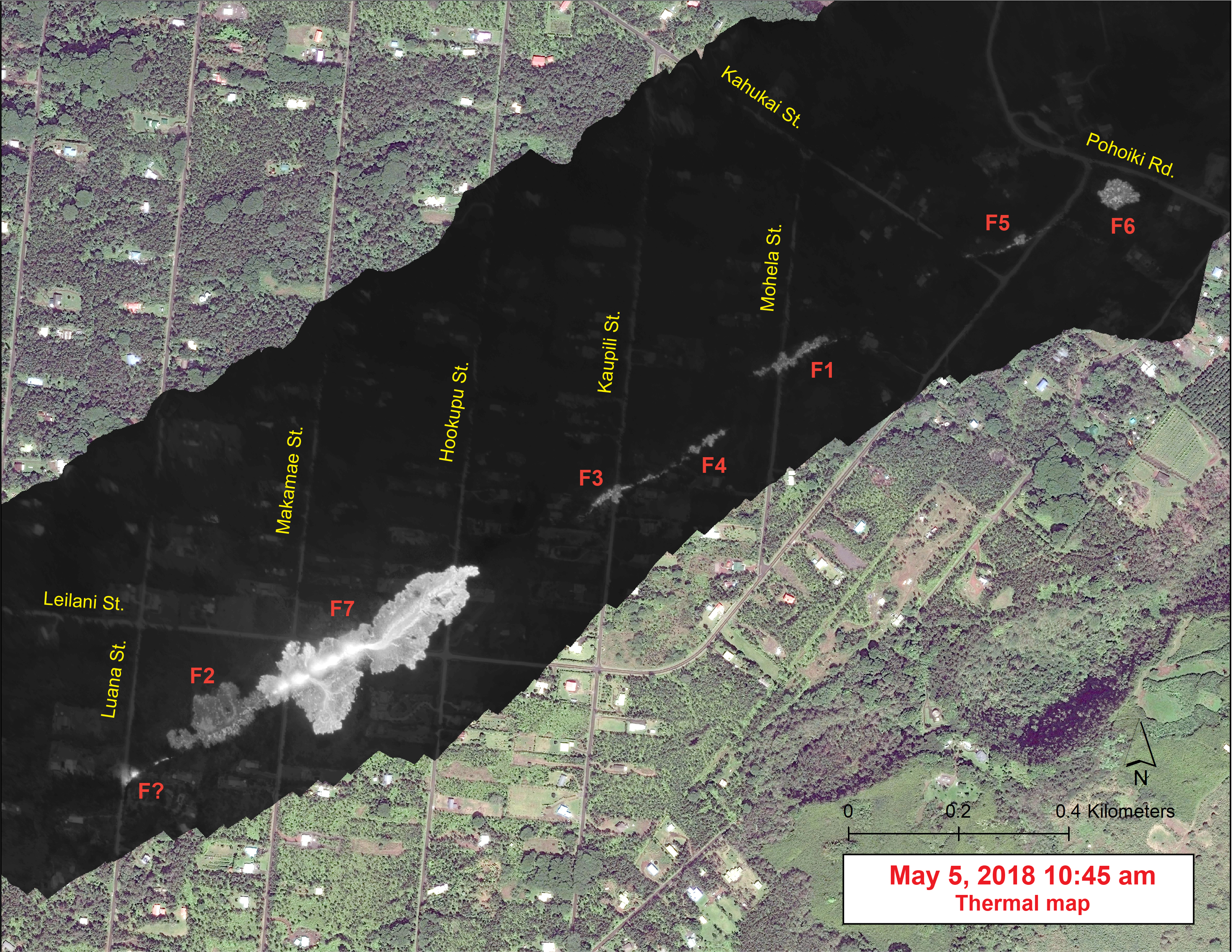
Thermal map of fissures and short lava flow, Leislani Estates

Detailed Description
This map overlays a georegistered mosaic of thermal images collected during a helicopter overflight of the fissures in Leilani Estates, Island of Hawai‘i. The base is a copyrighted satellite image (used with permission) provided by Digital Globe.
Temperature in the thermal image is displayed as gray-scale values, with the brightest pixels indicating the hottest areas (white shows active breakouts). During the overflight, fissure 7 stands out as the first fissure to produce a small lava flow. When the thermal images were collected, the flow was about 260 m (853 ft) long.
The thermal map was constructed by stitching many overlapping oblique thermal images collected by a handheld thermal camera during a helicopter overflight of the flow field.