



Three figures showing beach slope, dune crest and potential storm water levels on eastern US coasts
By St. Petersburg Coastal and Marine Science Center
2023 (approx.)


Detailed Description
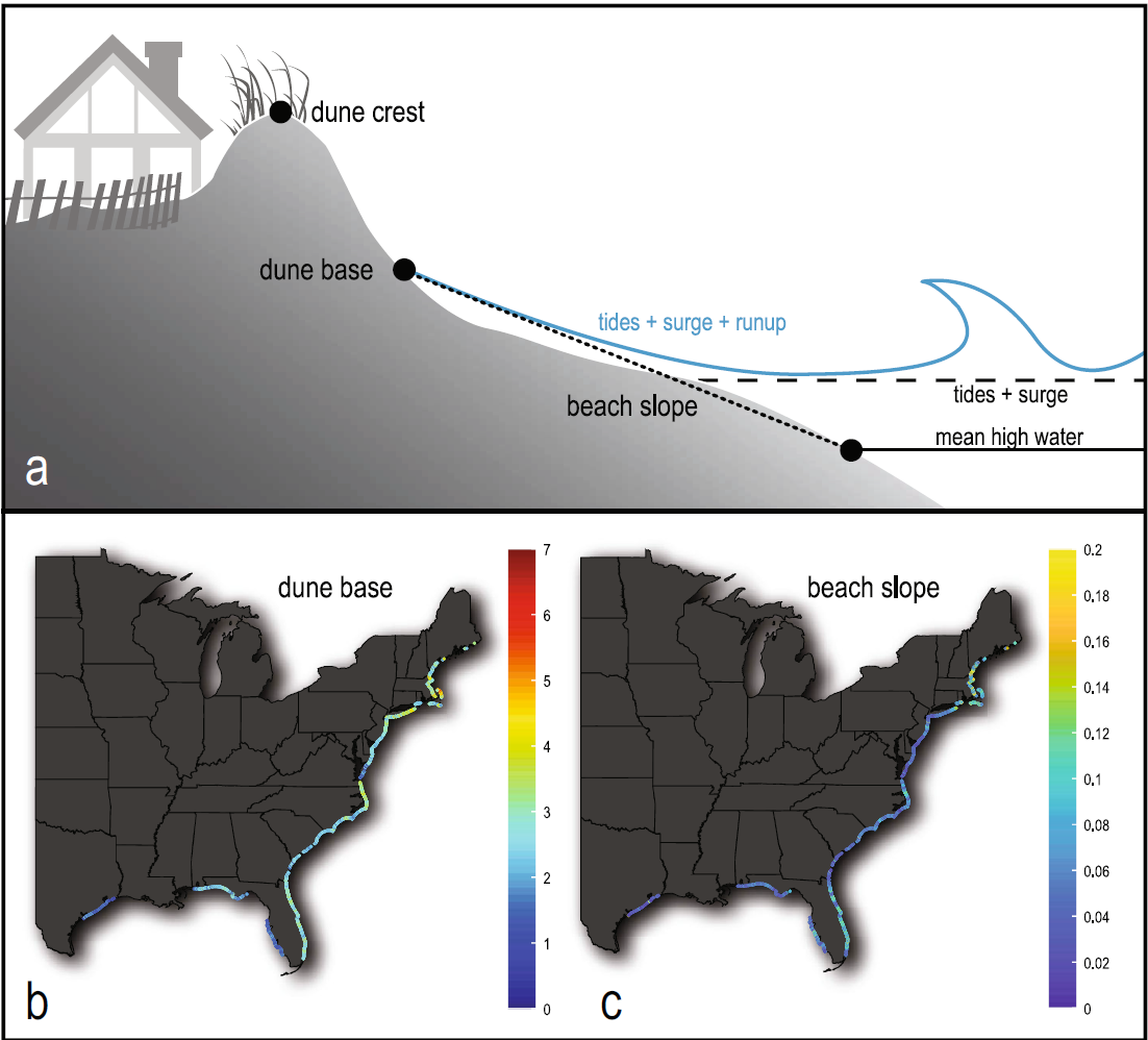
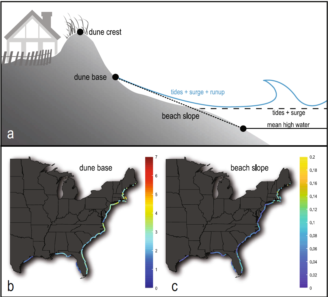
Figure 1a: Schematic drawing indicating beach slope, dune crest, dune toe, storm water levels. Figure 1b: Approximation of average dune toe/base elevation for parts of Atlantic and Gulf of Mexico coasts. Figure 1c: Approximation of beach slope for parts of Atlantic and Gulf of Mexico coasts. (Figure from Stockdon et al., 2023, Operational forecasts of wave-driven water levels and coastal hazards for US Gulf and Atlantic coasts: Communications Earth & Environment, https://doi.org/10.1038/s43247-023-00817-2)
Sources/Usage
Public Domain.
Related
Let’s Get Technical: Dunes & Beach Metrics
This webpage provides technical details regarding how the USGS calculates beach metrics related to morphology features; specifically, the dune crest position and elevation, the dune base/toe position and elevation and beach slope. This is a brief overview of that process with links and references to the full source material.
Related
Let’s Get Technical: Dunes & Beach Metrics
This webpage provides technical details regarding how the USGS calculates beach metrics related to morphology features; specifically, the dune crest position and elevation, the dune base/toe position and elevation and beach slope. This is a brief overview of that process with links and references to the full source material.