
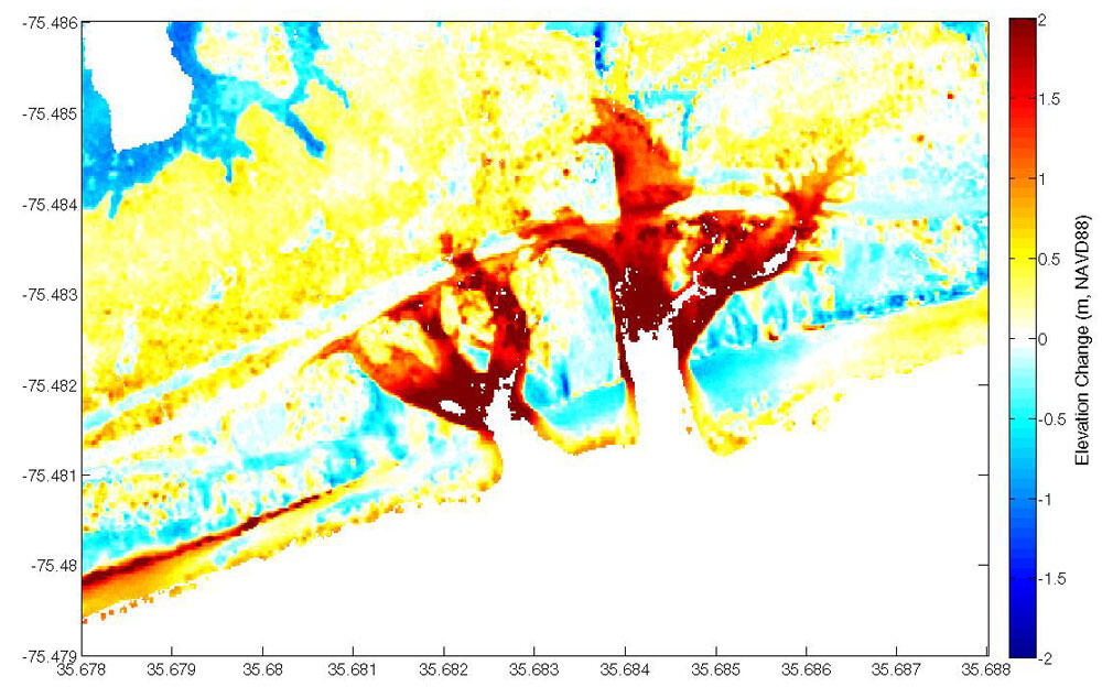
Topographic change at Pea Island, NC, after Hurricane Irene, 2011
By St. Petersburg Coastal and Marine Science Center
2011 (approx.)
Detailed Description
Topographic change (difference) for a portion of the Outer Banks in the Pea Island National Wildlife Refuge, NC, after Hurricane Irene in 2011. The difference image shows the intricate pattern of erosion associated with the formation of the breaches. Red colors indicate erosion. For example, oranges and reds on the seaward side of the islands indicate wide-spread shoreline retreat. Blue colors show areas of accretion, such as overwash deposits where waves and surge have moved sand landward. (The Atlantic Ocean is on the bottom right.)
Sources/Usage
Public Domain.