
Traces of the Hayward Fault, California
Detailed Description
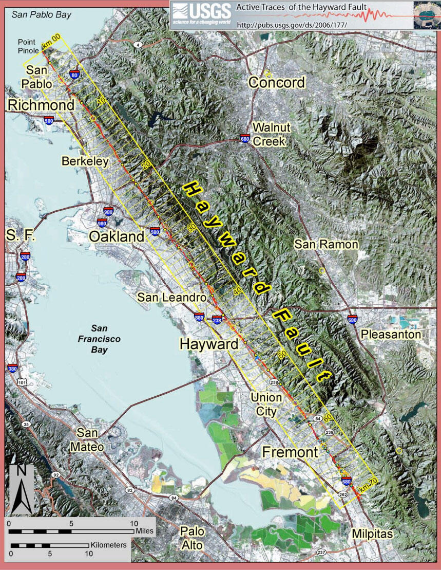
The purpose of this map is to show the location of and evidence for recent movement on active fault traces within the Hayward Fault Zone, California. The mapped traces represent the integration of the following three different types of data: (1) geomorphic expression, (2) creep (aseismic fault slip),and (3) trench exposures.