
Two UAS fly in formation during the joint NUSO and USGS Water Resources Mission Area snow water equivalent project in Winter Park Colorado

Detailed Description
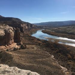
Two UAS fly in formation during the joint NUSO and USGS Water Resources Mission Area snow water equivalent project in Winter Park Colorado. These two UAS are carrying identical, experimental, software-defined radar sensors for measuring snow depth and density. Just like multiple telescopes can be used together providing greater detail about the stars, combining data from these two parallel radar sensors provides greater detail about the snow which translates into more accurate snow water equivalent (SWE) estimates.
NUSO scientists teamed with the USGS Water Resources Mission Area in a multi-year data collection effort to help develop and verify a process for generating snow depth measurements from UAS-collected LiDAR data from 2020 to 2022. This ability to calculate centimeter-level snow depth measurements from remotely sensed data also contributes to the USGS Next Generation Water Observing System (NGWOS) goal of remotely sensed mapping of snow conditions to better forecast snowmelt runoff in Colorado watersheds.
Sources/Usage
Public Domain.
Related
Integrated Water Science Basins: Upper Colorado River
Related