
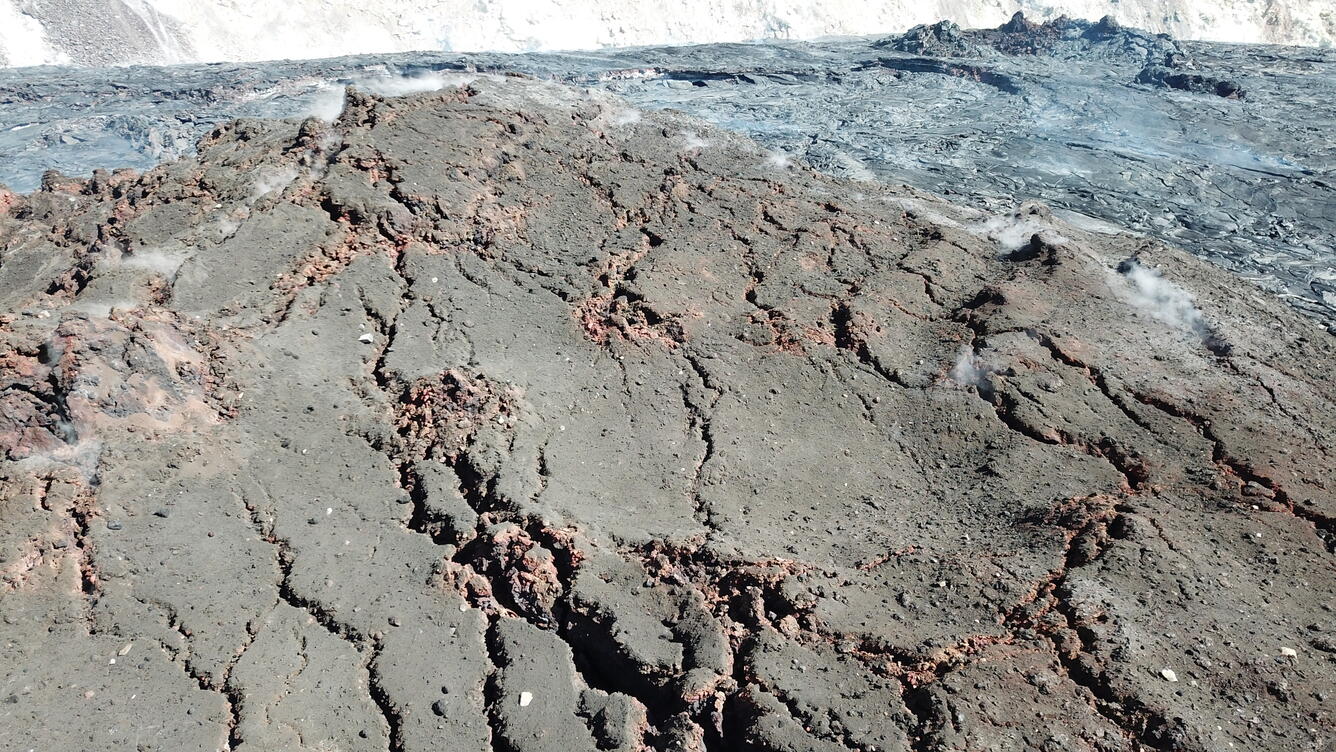
UAS close-up of main island within Halema‘uma‘u lava lake, March 16
Detailed Description
This close-up Unoccupied Aircraft System (UAS) photo of the main island within the Halema‘uma‘u lava lake was captured on Tuesday, March 16, 2021. The surface of the island is dotted with angular lava fragments, estimated to measure less than 0.3 m (1 ft) in diameter. These are believed to have been ejected by small explosions from the lake surface in the early hours of the eruption on December 20–21, 2020. In the background to the right, the top of the northern fissure spatter cone is visible. This was the primary eruptive vent for the first week of the eruption.
UAS photos like this help scientists to understand ongoing lava lake processes with their associated hazards, and to detect changes that might indicate shifts in the character of eruptive activity. USGS has special use permits from the National Park Service to conduct official UAS missions as part of HVO's mission to monitor active volcanoes in Hawaii, assess their hazards, issue warnings, and advance scientific understanding to reduce impacts of volcanic eruptions. Launching, landing, or operating an unmanned aircraft from or on lands and waters administered by the National Park Service within the boundaries of Hawai‘i Volcanoes National Park is prohibited under 36 CFR Closures & Public Use.
Sources/Usage
Public Domain.