
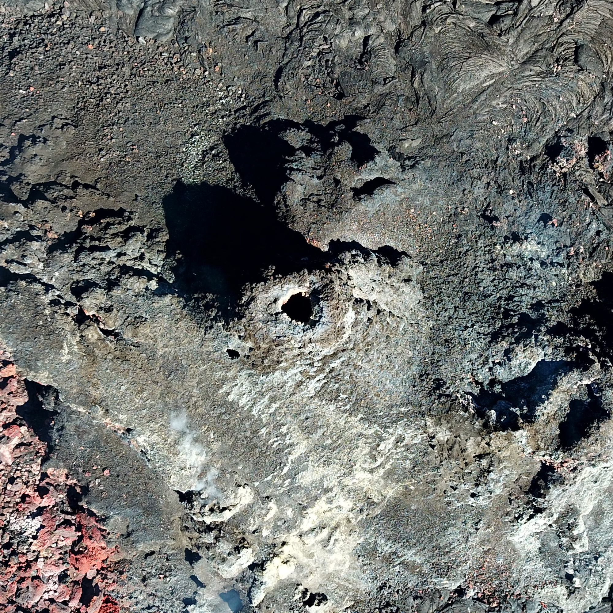
UAS view into inactive western fissure — Halema‘uma‘u, June 3, 2021

Detailed Description
This Unoccupied Aircraft Systems (UAS) photo, looking straight down into the inactive western fissure within Halema‘uma‘u at the summit of Kīlauea, was captured on Thursday, June 3, 2021. One of the objectives of the UAS mission was to get a close-up look into the fissure to see if any incandescent lava was still visible. As evidenced by the darkness within the opening atop the fissure (center of frame), no active lava was observed. For scale, the height and width of this photo each span approximately 40 m (131 ft) laterally.
UAS photos like this help scientists to understand ongoing volcanic processes and their associated hazards, and to detect changes that might indicate shifts in the character of activity. USGS has special use permits from the National Park Service to conduct official UAS missions as part of the Hawaiian Volcano Observatory's mission to monitor active volcanoes in Hawaii, assess their hazards, issue warnings, and advance scientific understanding to reduce impacts of volcanic eruptions. Launching, landing, or operating an unmanned aircraft from or on lands and waters administered by the National Park Service within the boundaries of Hawaii Volcanoes National Park is prohibited under 36 CFR Closures & Public Use.
Sources/Usage
Public Domain.