
Vertical displacements at GPS stations near Yellowstone lake
Detailed Description
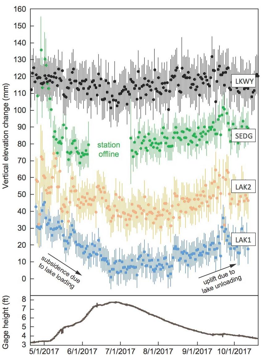
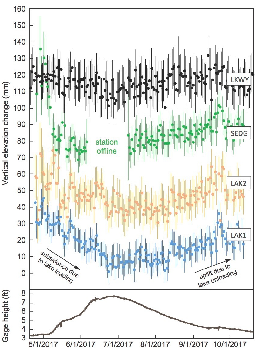
Time series of vertical displacements during April–October 2017 at four GPS stations near Yellowstone Lake: continuous station LKWY and temporary stations SEDG, LAK2, and LAK1. Downward trends indicate subsidence and upward trends show uplift. Error bars are one standard deviation. Bottom plot shows water level measured by stream gage USGS 06186500, located at the outlet of Yellowstone Lake. High gage levels correlate to high lake levels. Note that subsidence of the lake shore occurs simultaneously with increased lake level.
Sources/Usage
Public Domain.
Yellowstone Volcano Observatory