
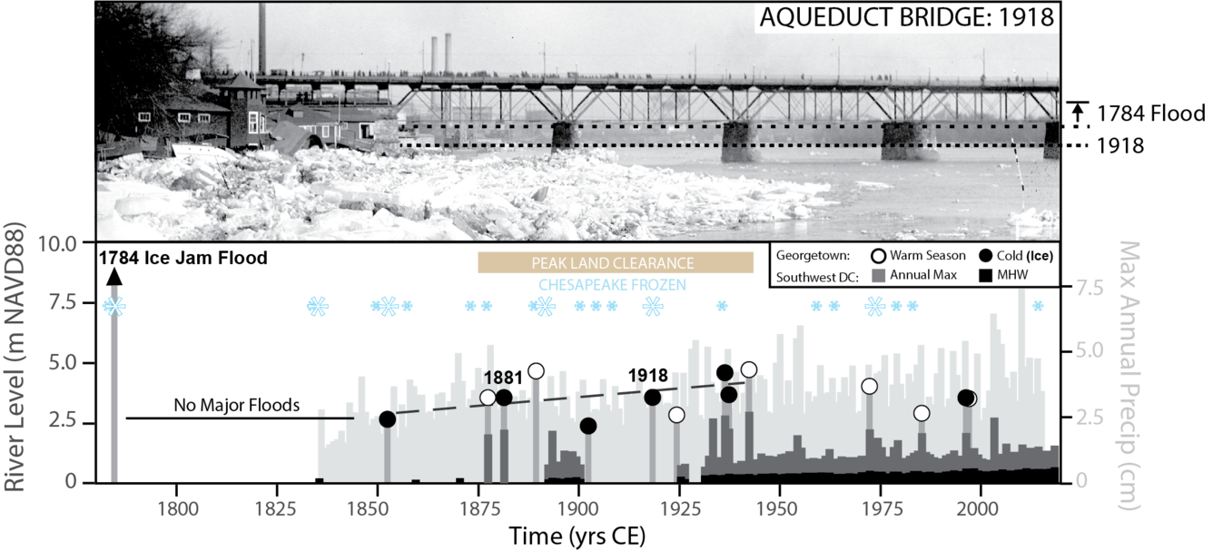
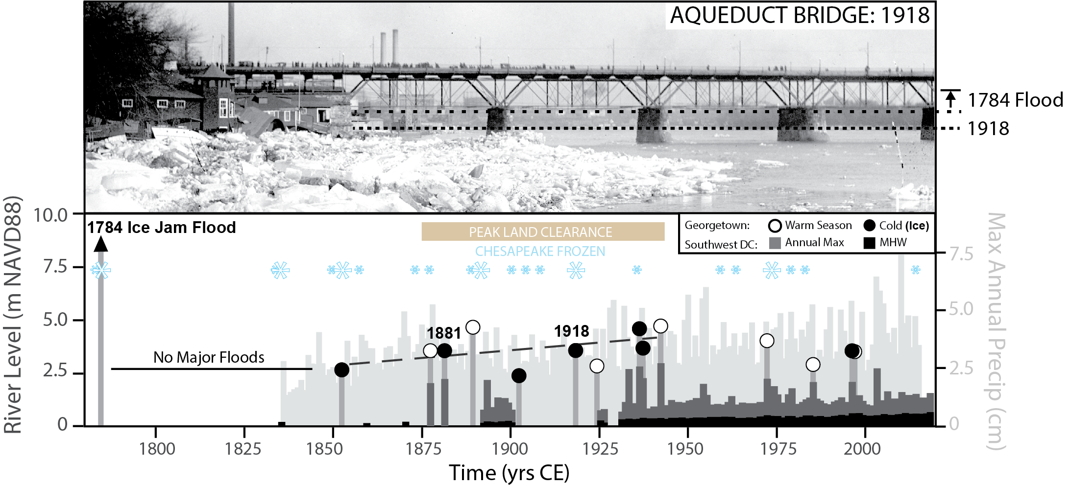
Washington D.C. Aqueduct Bridge after ice-jam breakup in 1918
Detailed Description
Historic flood records from Washington D.C. (Top) Photograph of the Aqueduct Bridge after ice-jam breakup in 1918. Flood crest visible from abrasion scars on the bridge piers. The ice jam during March 1784 would likely have overtopped piers. (Bottom) Combined instrumental and historic observations of Potomac floods at Washington. Gray bars with open and closed circles show the maximum flood heights for warm and cold season floods, respectively, at Georgetown (NW DC). Dark gray and black bars show the peak annual and mean high water levels, respectively, at NOAA tidal station 8594900. Light gray bars show the maximum annual rainfall (cm/day), across the Potomac watershed, derived from the NOAA-20th Century Reanalysis. Blue snowflakes show winters when 50% (small) or 75% (large) of Chesapeake was frozen.
Sources/Usage
Public Domain.
The full study is published online with open access: https://doi.org/10.1029/2025GL118329.
Related

500 Years of Extreme Potomac Floods at Washington D.C.
Related