
Wastewater observed seismicity map (2016)

Detailed Description
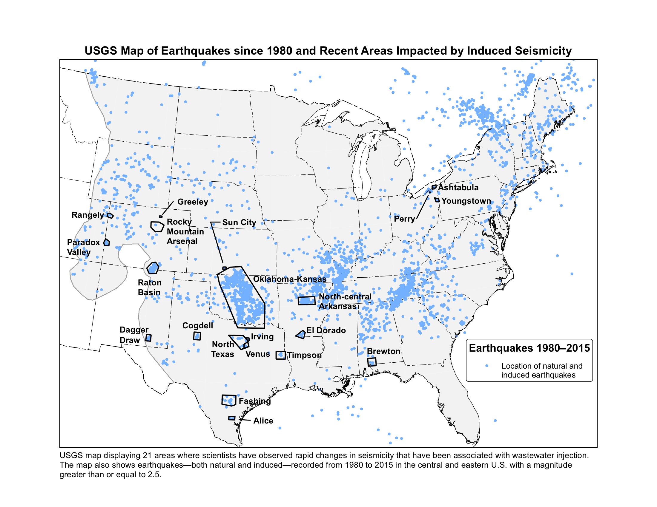
USGS map displaying 21 areas where scientists have observed rapid changes in seismicity that have been associated with wastewater injection. The map also shows earthquakes—both natural and induced—recorded from 1980 to 2015 in the central and eastern U.S. with a magnitude greater than or equal to 2.5.