
Water‑quality Monitoring Stations in Estuaries across Coastal Massachusetts
By New England Water Science Center
March 2026 (approx.)
Detailed Description
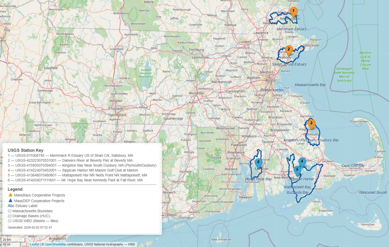
A map of USGS' continuous water‑quality monitoring stations in estuaries across coastal Massachusetts. This data is being collected in collaboration with the Massachusetts Bays National Estuary Partnership (MassBays) and the Massachusetts Department of Environmental Protection (MassDEP) to support Clean Water Act objectives, inform estuarine restoration goals, and provide baseline data for long-term ecosystem health tracking.
Sources/Usage
Public Domain.
Related
Coastal Water-Quality Monitoring in Massachusetts
The U.S. Geological Survey (USGS) operates high‑resolution, continuous water‑quality monitoring stations in estuaries across coastal Massachusetts to better understand these dynamic ecosystems. These efforts include collaborations with the Massachusetts Bays National Estuary Partnership (MassBays) and the Massachusetts Department of Environmental Protection (MassDEP) to support Clean Water Act...