
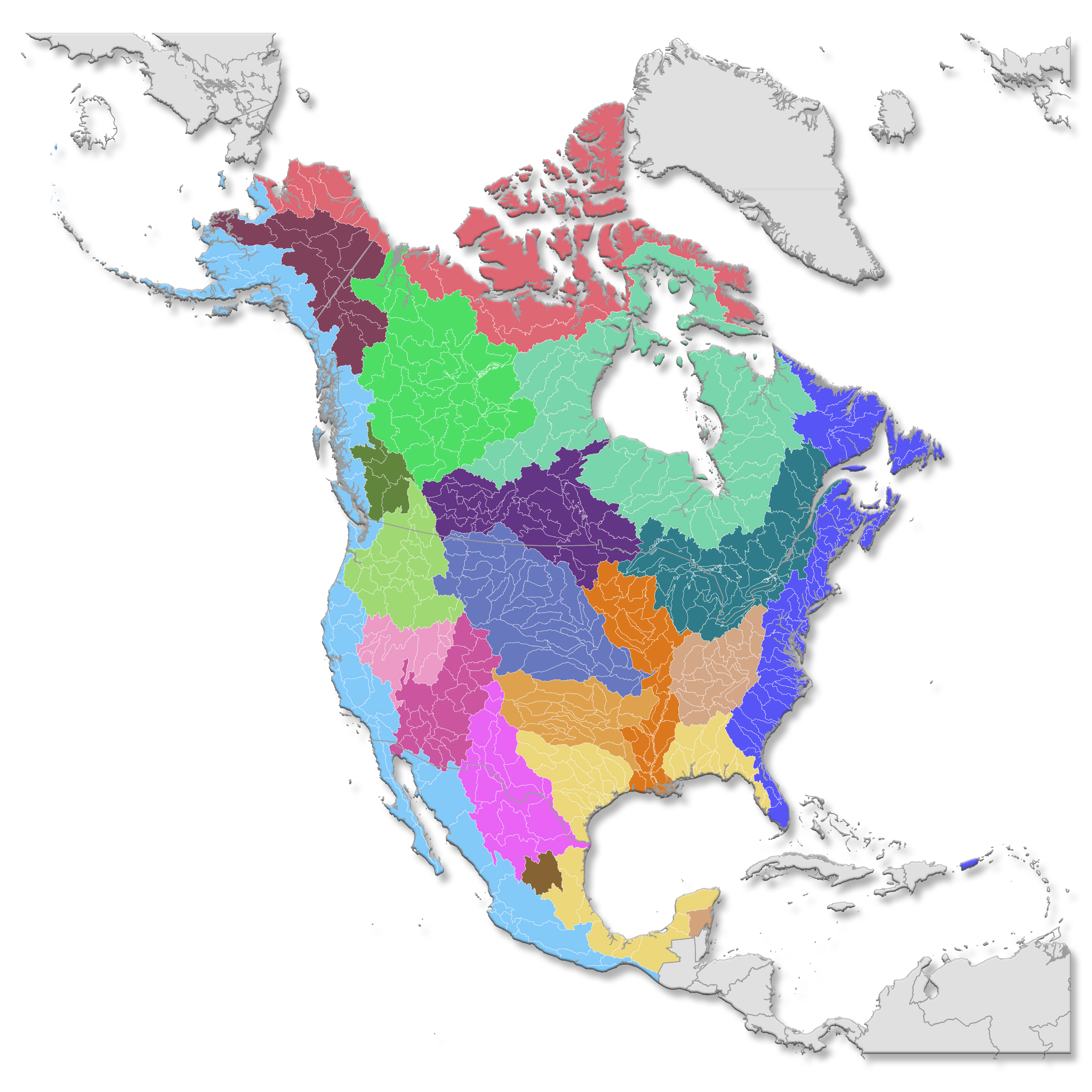
Watershed Map of North America

Detailed Description
Watershed map of North America showing 2-digit hydrologic units.
A watershed is an area of land that drains all the streams and rainfall to a common outlet such as the outflow of a reservoir, mouth of a bay, or any point along a stream channel. Watersheds can be as small as a footprint or large enough to encompass all the land that drains water into rivers that drain into Chesapeake Bay, where it enters the Atlantic Ocean. This map shows one set of watershed boundaries in the continental United States; these are known as National hydrologic units (watersheds).
► Find out more:
Sources/Usage
Public Domain.
Related

Watersheds and Drainage Basins
When looking at the location of rivers and the amount of streamflow in rivers, the key concept is the river's "watershed". What is a watershed? Easy, if you are standing on ground right now, just look down. You're standing, and everyone is standing, in a watershed.
Related
Watersheds and Drainage Basins
When looking at the location of rivers and the amount of streamflow in rivers, the key concept is the river's "watershed". What is a watershed? Easy, if you are standing on ground right now, just look down. You're standing, and everyone is standing, in a watershed.