
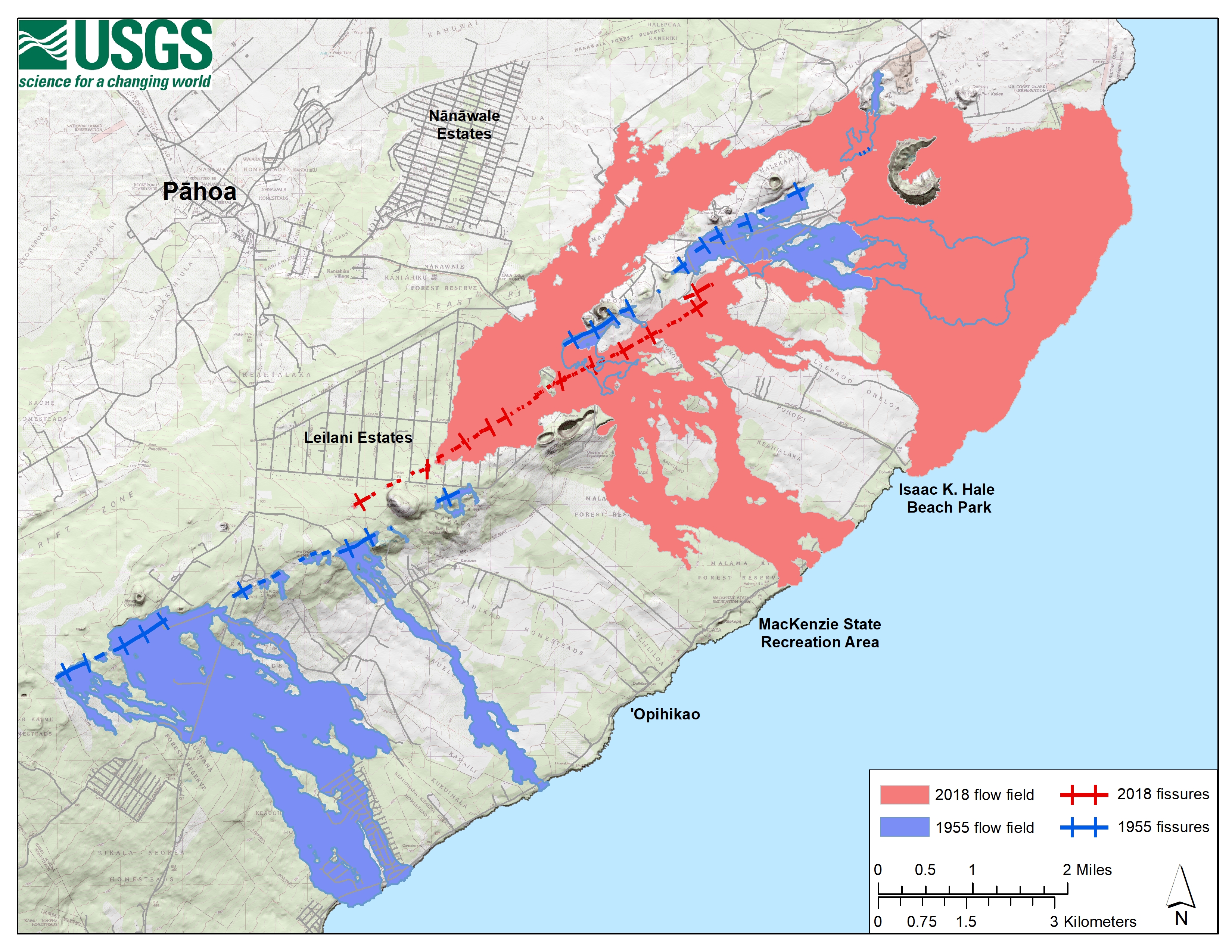
This week marks 65 years since Kīlauea Volcano's 1955 eruption

Detailed Description
A map of the lower East Rift Zone of KÄ"lauea Volcano showing the fissures and flow fields from the 1955 (blue) and 2018 (pink) eruptions. Portions of the 1955 lava flows that were covered during the 2018 eruption, are represented with a blue outline. USGS map.
Sources/Usage
Public Domain.