
Well-withdrawal footprint map, Azraq Oasis, Jordan
By National Science Foundation/USGS Internship Opportunities
2010 (approx.)
Detailed Description
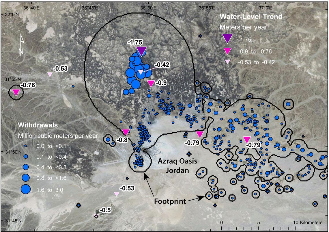
Large groundwater withdrawals in the Azraq Oasis area, Jordan, have contributed to declining water levels in wells. This map shows the withdrawal footprint and observed water-level trends (labeled triangular symbols, from Goode et al. 2013). The footprint depth-rate index is 0.1 meter per year (m/yr), corresponding to a water-level decline rate of 1 m/yr, scaled by a specific yield of 0.1. (All hydrologic data provided by Jordan Ministry of Water and Irrigation; imagery ESRI 2015)
Sources/Usage
Public Domain.