



Whitewater cataraft and lidar point cloud
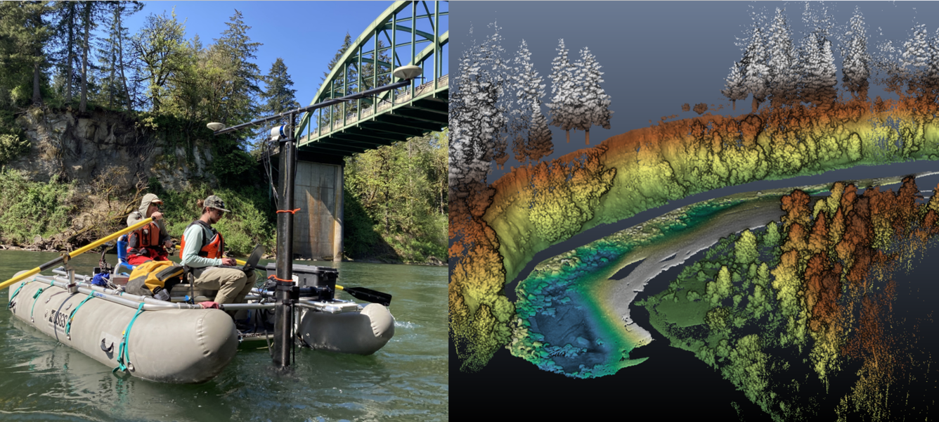
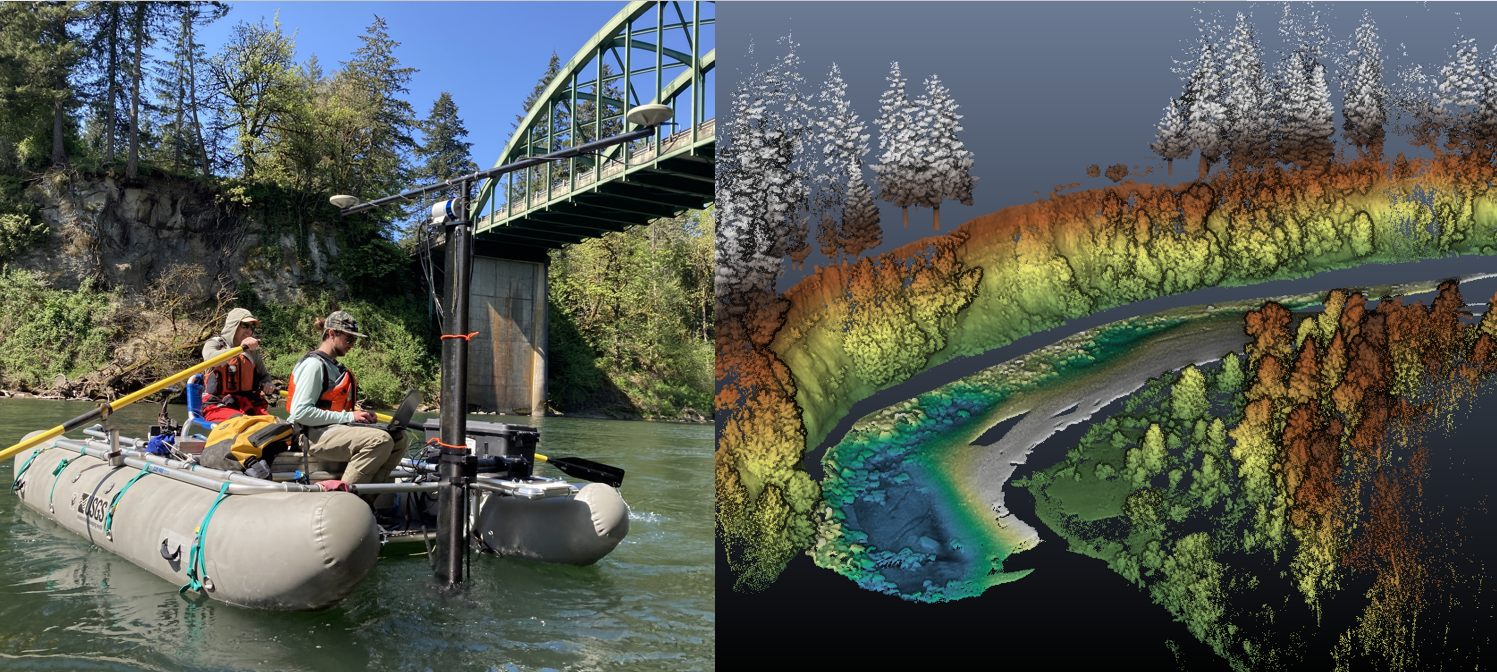


Detailed Description
Left: A whitewater cataraft equipped with a multibeam sonar (underwater) and lidar scanner (above water) capture detailed bathymetry and surface topography on the Clackamas River. Right: A 3‑D point cloud collected from the combined multibeam sonar and lidar survey along the Clackamas River. The scene is built entirely from millions of individual points, each with its own position and color, creating a detailed model of the river corridor. Points are colored based on elevation.
Sources/Usage
Public Domain.
Related
Geospatial Data Collection in the Willamette River Basin
A USGS geospatial data collection initiative in Oregon’s Willamette River Basin uses advanced remote sensing and on‑the‑ground measurements to map major rivers draining the Cascade Range. This work helps track how changing water resources and river channel conditions affect a wide array of water‑management needs, river hazards, recreational users, and habitat for ESA-listed spring Chinook salmon...
Related
Geospatial Data Collection in the Willamette River Basin
A USGS geospatial data collection initiative in Oregon’s Willamette River Basin uses advanced remote sensing and on‑the‑ground measurements to map major rivers draining the Cascade Range. This work helps track how changing water resources and river channel conditions affect a wide array of water‑management needs, river hazards, recreational users, and habitat for ESA-listed spring Chinook salmon...