
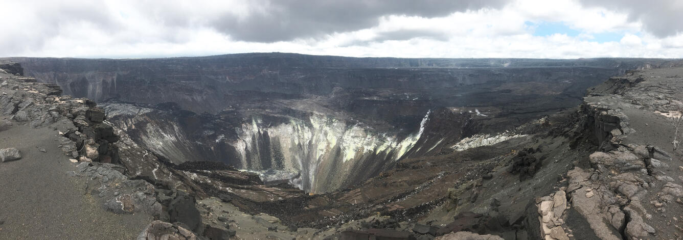
Wide view of the 2018 summit collapse from the south rim
Detailed Description
This panorama shows the view from the south rim of the 2018 collapse at Kīlauea's summit, and provides a sense of the expansiveness of the collapse. The yellow fumarolic areas in the center of the photo are on the north wall of Halema‘uma‘u, which has the slowly rising water lake filling its lowest portion. A small sliver of the water can be seen near the bottom of the photo. In the right side of the photo, the downdropped block can be seen. In the bottom center of the photo, the remains of Crater Rim Drive and the Halema‘uma‘u parking lot can be seen. Prior to 2018 these were at approximately the same elevation as the spot where the photo was taken, and they are now 110 m (360 feet) below this spot. The former HVO building and Jaggar Museum (both damaged during 2018) can be seen as a small bump on the skyline, just left of the centerline of the photo. USGS photo by M. Patrick.
Sources/Usage
Public Domain.